
Time zone CET/CEST (UTC+1/+2) Area 6.39 km² Local time Tuesday 7:08 PM Dialling code 06737 | Elevation 124 m (407 ft) Postal codes 55278 Population 1,584 (31 Dec 2008) Postal code 55278 Municipal assoc. Rhein-Selz | |
 | ||
Weather 12°C, Wind W at 6 km/h, 52% Humidity | ||
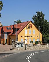
Hahnheim is an Ortsgemeinde – a municipality belonging to a Verbandsgemeinde, a kind of collective municipality – in the Mainz-Bingen district in Rhineland-Palatinate, Germany.
Contents
- Map of 55278 Hahnheim Germany
- Location
- Municipal council
- Coat of arms
- Jewish graveyard
- Biotopes
- Transport
- References
Map of 55278 Hahnheim, Germany
Location
Hahnheim lies between Mainz and Worms on the river Selz. The winegrowing centre belongs to the Verbandsgemeinde Rhein-Selz, whose seat is in Oppenheim.
Municipal council
The council is made up of 17 council members, counting the part-time mayor, with seats apportioned thus:
(as at municipal election held on 13 June 2004)
Coat of arms
The municipality’s arms might be described thus: Per fess gules and argent, a cock repassant counterchanged.
Jewish graveyard
In the countryside towards Köngernheim on the highway going towards Bundesstraße 420 is an old Jewish graveyard.
Biotopes
In the countryside, especially along the Selz and on the former Alzey–Bodenheim railway right-of-way – the “Amiche” – several biotopes have been established.
Transport
The municipality is crossed by the L 432 state road. Bundesstraße 420 lies 2 km to the south. The A 60 and A 63 autobahns can be reached by car in 20 and 10 minutes respectively.