
Highest elevation 657 m (2,156 ft) Max length 15 km Municipality Hadsel | Width 10 km (6 mi) Highest point Lamlitind Area 102 km² | |
 | ||
Points of interest Hurtigruten Museum, Hurtigrutenmuseum, Norsk Fiskeindustrimuseum, Museum Nord ‑ Vesterålsmuseet | ||
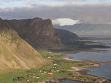
Hadseløya is an island in the municipality of Hadsel in Nordland county, Norway. It is located in the Vesterålen region on the north side of the Hadselfjorden. The town of Stokmarknes is situated on the northern shore of the island and the village of Melbu is on the southern coast.
Map of Hadsel%C3%B8ya, Hadsel, Norway
The island has an area of 102 square kilometres (39 sq mi). The 657-metre (2,156 ft) tall mountain Lamlitind is the highest point on the island. Hadseløya is connected to the neighboring island of Langøya by the Hadsel Bridge. There is also a ferry connection from Melbu to Fiskebøl on Austvågøya island to the south.
References
Hadseløya Wikipedia(Text) CC BY-SA