
Type man-made reservoir Surface area 220 acres (89 ha) Settlements Fort Ann, NY Surface elevation 133 m | Basin countries United States Islands two Area 89 ha Cities Fort Ann | |
 | ||
Similar Adirondack Mountains, Great Escape, Old Stone House Library, West Mountain, Champlain Canal | ||
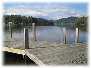
Hadlock Pond, also known as Lake Hadlock or Sunderland Pond, is a small man-made reservoir formed on a tributary of Halfway Creek in the town of Fort Ann in Washington County, New York, United States.
Map of Hadlock Pond, Fort Ann, NY 12827, USA
Constructed in 1896, the original dam was of earthen construction, or rock fill. It had a height of 29 feet (8.8 m), with a width of 850 feet (260 m). The dam was reconstructed in 2005, only to collapse months later, flooding and damaging nearby property.
The pond is owned by the town of Fort Ann, and is primarily used for recreational purposes. The pond has a surface area of 220 acres (0.89 km2).
References
Hadlock Pond Wikipedia(Text) CC BY-SA