
Country Philippines Barangays ZIP code 7413 Local time Tuesday 10:21 PM | District 1st district of Sulu Time zone PST (UTC+8) Area 67.9 km² Province Sulu | |
 | ||
Region Autonomous Region in Muslim Mindanao (ARMM) Weather 26°C, Wind N at 8 km/h, 90% Humidity | ||
Hadji Panglima Tahil (formerly as Marunggas) is a sixth class municipality in the province of Sulu, Philippines. According to the 2015 census, it has a population of 6,375 people.
Contents
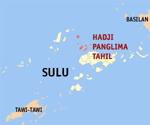
Map of Municipality of Hadji Panglima Tahil, Sulu, Philippines
As of 2000, it was the poorest municipality in the Philippines with a poverty incidence estimate of 89.7%.
Barangays
Hadji Panglima Tahil is politically subdivided into 5 barangays.
References
Hadji Panglima Tahil, Sulu Wikipedia(Text) CC BY-SA