
Country United States Incorporated March 2, 1904 Area 4.076 km² Population 7,428 (2013) | Founded 1699 Zip code 08035 Local time Tuesday 9:35 AM | |
 | ||
Weather 0°C, Wind N at 39 km/h, 90% Humidity | ||
Haddon Heights is a borough in Camden County, New Jersey, United States. As of the 2010 United States Census, the borough's population was 7,473, reflecting a decline of 74 (-1.0%) from the 7,547 counted in the 2000 Census, which had in turn declined by 313 (-4.0%) from the 7,860 counted in the 1990 Census.
Contents
- Map of Haddon Heights NJ USA
- History
- Geography
- 2010 Census
- 2000 Census
- Local government
- Federal state and county representation
- Politics
- Education
- Roads and highways
- Public transportation
- Notable people
- References
Map of Haddon Heights, NJ, USA
Haddon Heights was incorporated as a borough by an act of the New Jersey Legislature on March 2, 1904, from portions of the now-defunct Centre Township and parts of Haddon Township. Haddon Heights is a dry town where alcohol cannot be sold. The borough was named for Elizabeth Haddon, an early settler of the area.
New Jersey Monthly magazine ranked Haddon Heights as the 98th best place to live in New Jersey in its 2008 rankings of the "Best Places To Live" in New Jersey, and the borough has also been listed among its "Classic Towns of Greater Philadelphia" by the Delaware Valley Regional Planning Commission. In 2011, New Jersey Monthly named Haddon Heights the second best town to live in Southern New Jersey, after Moorestown Township.
History
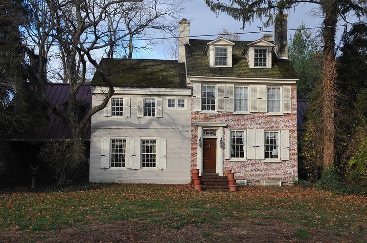
The land that was to become Haddon Heights was settled in 1699 by John Hinchman. In 1713, John Siddon built a farmhouse near Hinchman's property. John Thorn Glover dammed King's Run and constructed a mill race and fulling mill on this property before 1776. Jacob Hinchman built a frame dwelling no later than 1720 that was later enlarged by American Revolutionary War hero Col. Joseph Ellis. New Jersey governor Joseph Bloomfield later purchased this property.
In 1890, Benjamin A. Lippincott constructed a passenger station in the center of his land for the Atlantic City Railroad. Then Lippincott, with Charles Hillman, filed a grid street plan with Camden County to develop a community. They named it Haddon Heights because of its proximity to Haddonfield and its high elevation. Large houses were constructed that appealed to prosperous middle-class families moving from the cities. In 1904, Haddon Heights was incorporated as a borough and Lippincott was elected mayor. A small downtown grew near the railroad and the White Horse Pike and eight churches and a synagogue were built. An area of old Centre Township, known as Fairfield Estates, voted in 1926 to become part of Haddon Heights. This land was developed for more single-family housing through the 1940s and 1950s. Even though rail passenger service ceased in July 1965, Haddon Heights remains a typical turn-of-the-twentieth-century railroad suburb with tree-shaded streets and comfortable homes.
Geography
According to the United States Census Bureau, the borough had a total area of 1.574 square miles (4.076 km2), including 1.569 square miles (4.063 km2) of land and 0.005 square miles (0.014 km2) of water (0.33%).
The borough borders Audubon, Mount Ephraim, Barrington, Bellmawr, and Haddonfield.
2010 Census
The 2010 United States Census counted 7,473 people, 2,997 households, and 2,023 families residing in the borough. The population density was 4,764.1 per square mile (1,839.4/km2). The borough contained 3,159 housing units at an average density of 2,013.9 per square mile (777.6/km2). The racial makeup of the borough was 95.45% (7,133) White, 1.12% (84) Black or African American, 0.16% (12) Native American, 1.31% (98) Asian, 0.07% (5) Pacific Islander, 0.54% (40) from other races, and 1.35% (101) from two or more races. Hispanics or Latinos of any race were 2.65% (198) of the population.
Out of a total of 2,997 households, 29.4% had children under the age of 18 living with them, 55.6% were married couples living together, 8.8% had a female householder with no husband present, and 32.5% were non-families. 28.4% of all households were made up of individuals, and 13.0% had someone living alone who was 65 years of age or older. The average household size was 2.49 and the average family size was 3.10.
In the borough, 22.9% of the population were under the age of 18, 6.5% from 18 to 24, 23.9% from 25 to 44, 30.7% from 45 to 64, and 16.0% who were 65 years of age or older. The median age was 42.6 years. For every 100 females the census counted 91.5 males, but for 100 females at least 18 years old, it was 87.9 males.
The Census Bureau's 2006-2010 American Community Survey showed that (in 2010 inflation-adjusted dollars) median household income was $82,663 (with a margin of error of +/- $9,335) and the median family income was $101,943 (+/- $5,362). Males had a median income of $75,785 (+/- $5,098) versus $58,912 (+/- $4,731) for females. The per capita income for the borough was $40,913 (+/- $3,618). About 0.0% of families and 1.0% of the population were below the poverty line, including 0.0% of those under age 18 and 3.3% of those age 65 or over.
2000 Census
As of the 2000 United States Census there were 7,547 people, 3,039 households, and 2,039 families residing in the borough. The population density was 4,855.5 people per square mile (1,879.9/km2). There were 3,136 housing units at an average density of 2,017.6 per square mile (781.2/km2). The racial makeup of the borough was 97.97% White, 0.40% African American, 0.11% Native American, 0.65% Asian, 0.04% Pacific Islander, 0.27% from other races, and 0.57% from two or more races. Hispanic or Latino of any race were 1.05% of the population.
There were 3,039 households out of which 30.6% had children under the age of 18 living with them, 56.4% were married couples living together, 8.2% had a female householder with no husband present, and 32.9% were non-families. 28.5% of all households were made up of individuals and 14.7% had someone living alone who was 65 years of age or older. The average household size was 2.48 and the average family size was 3.09.
In the borough the population was spread out with 24.1% under the age of 18, 5.3% from 18 to 24, 28.2% from 25 to 44, 24.2% from 45 to 64, and 18.2% who were 65 years of age or older. The median age was 41 years. For every 100 females there were 89.0 males. For every 100 females age 18 and over, there were 86.3 males.
The median income for a household in the borough was $58,424, and the median income for a family was $73,460. Males had a median income of $51,572 versus $35,208 for females. The per capita income for the borough was $28,198. About 1.0% of families and 2.8% of the population were below the poverty line, including 1.9% of those under age 18 and 5.3% of those age 65 or over.
Local government
Haddon Heights is governed under the borough form of New Jersey municipal government. The governing body consists of a mayor and a borough council comprising six council members, with all positions elected at-large on a partisan basis as part of the November general election. A mayor is elected directly by the voters to a four-year term of office. The borough council consists of six members elected to serve three-year terms on a staggered basis, with two seats coming up for election each year in a three-year cycle. The borough form of government used by Haddon Heights, the most common system used in the state, is a "weak mayor / strong council" government in which council members act as the legislative body, with the mayor presiding at meetings and voting only in the event of a tie. The mayor can veto ordinances subject to an override by a two-thirds majority vote of the council. The mayor makes committee and liaison assignments for council members, and most appointments are made by the mayor with the advice and consent of the council.
The reorganization meeting of the governing body is held on the first Saturday in January. At this meeting, the newly elected council members take the oath of office and a council president, who serves as acting mayor when the mayor is absent, is elected by the council. Appointments for the coming year are announced by the mayor and confirmed by the council when required by law.
As of 2016, the mayor of Haddon Heights is Republican Jack D. Merryfield Jr., whose term of office ends December 31, 2019. Members of the borough council are Council President Kathryn Lange (R, 2017), Stephen D. Berryhill (D, 2018), Vincent M. Ceroli (R, 2016; appointed to serve an unexpired term), Richard DiRenzo (R, 2017), Susan R. Griffith (R, 2016) and Jacquelyn E. Valvardi (R, 2018).
In March 2016, the Borough Council selected Vincent Ceroli from three canddiates nominated by the Republican municipal committee to fill the seat expiring in December 2016 that had been held by Earl R. Miller Jr. until he resigned from office.
Federal, state and county representation
Haddon Heights is located in the 1st Congressional District and is part of New Jersey's 5th state legislative district.
New Jersey's First Congressional District is represented by Donald Norcross (D, Camden). New Jersey is represented in the United States Senate by Cory Booker (D, Newark, term ends 2021) and Bob Menendez (D, Paramus, 2019).
For the 2016–2017 session (Senate, General Assembly), the 5th Legislative District of the New Jersey Legislature is represented in the State Senate by Nilsa Cruz-Perez (D, Barrington) and in the General Assembly by Arthur Barclay (D, Camden) and Patricia Egan Jones (D, Barrington). The Governor of New Jersey is Chris Christie (R, Mendham Township). The Lieutenant Governor of New Jersey is Kim Guadagno (R, Monmouth Beach).
Camden County is governed by a Board of Chosen Freeholders, whose seven members chosen at-large in partisan elections to three-year terms office on a staggered basis, with either two or three seats coming up for election each year. As of 2015, Camden County's Freeholders are Freeholder Director Louis Cappelli, Jr. (Collingswood, term as freeholder ends December 31, 2017; term as director ends 2015), Freeholder Deputy Director Edward T. McDonnell (Pennsauken Township, term as freeholder ends 2016; term as deputy director ends 2015), Michelle Gentek (Gloucester Township, 2015), Ian K. Leonard (Camden, 2015), Jeffrey L. Nash (Cherry Hill, 2015), Carmen Rodriguez (Merchantville, 2016) and Jonathan L. Young, Sr. (Berlin Township, November 2015; serving the unexpired term of Scot McCray ending in 2017)
Camden County's constitutional officers, all elected directly by voters, are County clerk Joseph Ripa, Sheriff Charles H. Billingham, and Surrogate Patricia Egan Jones. The Camden County Prosecutor Mary Eva Colalillo was appointed by the Governor of New Jersey with the advice and consent of the New Jersey Senate (the upper house of the New Jersey Legislature).
Politics
As of March 23, 2011, there were a total of 5,754 registered voters in Haddon Heights, of which 2,137 (37.1%) were registered as Democrats, 1,310 (22.8%) were registered as Republicans and 2,300 (40.0%) were registered as Unaffiliated. There were 7 voters registered to other parties.
In the 2012 presidential election, Democrat Barack Obama received 54.8% of the vote (2,352 cast), ahead of Republican Mitt Romney with 44.0% (1,891 votes), and other candidates with 1.2% (51 votes), among the 4,326 ballots cast by the borough's 6,019 registered voters (32 ballots were spoiled), for a turnout of 71.9%. In the 2008 presidential election, Democrat Barack Obama received 55.8% of the vote (2,548 cast), ahead of Republican John McCain, who received around 41.4% (1,893 votes), with 4,568 ballots cast among the borough's 5,586 registered voters, for a turnout of 81.8%. In the 2004 presidential election, Democrat John Kerry received 53.2% of the vote (2,411 ballots cast), outpolling Republican George W. Bush, who received around 45.1% (2,045 votes), with 4,534 ballots cast among the borough's 5,562 registered voters, for a turnout percentage of 81.5.
In the 2013 gubernatorial election, Republican Chris Christie received 65.2% of the vote (1,821 cast), ahead of Democrat Barbara Buono with 33.2% (928 votes), and other candidates with 1.5% (43 votes), among the 2,859 ballots cast by the borough's 6,010 registered voters (67 ballots were spoiled), for a turnout of 47.6%. In the 2009 gubernatorial election, Republican Chris Christie received 47.4% of the vote (1,450 ballots cast), ahead of both Democrat Jon Corzine with 43.7% (1,338 votes) and Independent Chris Daggett with 6.4% (195 votes), with 3,059 ballots cast among the borough's 5,680 registered voters, yielding a 53.9% turnout.
Education
The Haddon Heights School District serves public school students in kindergarten through twelfth grade. As of the 2011-12 school year, the district's four schools had an enrollment of 1,334 students and 117.0 classroom teachers (on an FTE basis), for a student–teacher ratio of 11.40:1. Schools in the district (with 2011-12 enrollment data from the National Center for Education Statistics) are three elementary schools — Atlantic Avenue Elementary School (166 students; grades K-6), Glenview Elementary School (211; PreK-6) and Seventh Avenue Elementary School (133; K-6) — and Haddon Heights High School for grades 7-12 (824). The districts' high school also serves students from the neighboring communities of Barrington and Lawnside who attend the high school as part of sending/receiving relationships.
St. Rose of Lima School, founded in 1921, is a K-8 elementary school that operates under the auspices of the Roman Catholic Diocese of Camden.
Baptist Regional School is a private, co-educational K-12 college-preparatory school governed by a board of directors in association with Haddon Heights Baptist Church (GARBC). The school offers an integrated curriculum with a conservative Christian worldview.
Roads and highways
As of May 2010, the borough had a total of 30.82 miles (49.60 km) of roadways, of which 22.06 miles (35.50 km) were maintained by the municipality, 6.52 miles (10.49 km) by Camden County and 2.24 miles (3.60 km) by the New Jersey Department of Transportation.
Interstate 295 follows the southern border of the borough, while Route 168 straddles the western border and Route 41 follows the eastern border.
Public transportation
NJ Transit local bus service between the borough and Philadelphia is provided on the 400 and 403 routes, with local service available on the 455 and 457 routes.
Commuter train service to Philadelphia is available using the PATCO Speedline. The closest stops are Westmont and Haddonfield.
Notable people
People who were born in, residents of, or otherwise closely associated with Haddon Heights include: