
Population 616 (2006 census) Postal code 5069 | Postcode(s) 5069 Local time Tuesday 11:01 PM | |
 | ||
Weather 22°C, Wind E at 11 km/h, 51% Humidity | ||
Hackney is a suburb of Adelaide in the City of Norwood Payneham St Peters. It is adjacent to the City centre and North Adelaide. Part of the O Bahn system lies here and presently, this system is being upgraded. Hackney Road and Payneham Road are main roads running through the suburb. Hackney Road is part of the City Ring Route, Adelaide. There are many expensive houses in this area.
Map of Hackney SA 5069, Australia
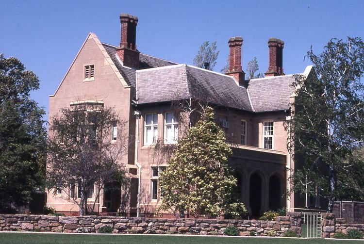
St Peter's College, an independent boys school near the Adelaide Parklands, is located within the suburb. This college is more than a hundred years old. Three historic buildings in the college, the Old School House, Big Quad Precinct and Palm House, are listed on the South Australian Heritage Register.
Parts of Adelaide Botanic Gardens, Botanic Park, Adelaide and the National Wine Centre are in close proximity to Hackney.
Romilly House on North Terrace is also listed on the Heritage Register.