
OS grid reference SK288617 Country England Post town MATLOCK Shire county Derbyshire Dialling code 01629 | Region East Midlands Sovereign state United Kingdom Postcode district DE4 District Derbyshire Dales | |
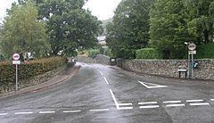 | ||
Hackney and Upper Hackney are areas of settlement in Derbyshire, England. The population taken at the 2011 Census is included in the civil parish of Darley Dale.
Map of Hackney, Matlock, UK
They are located to the north west of Matlock, and separated from the River Derwent by the A6 road and the Peak Rail railway line. There is a Methodist chapel in the village, whilst the nearest C of E church is St. Helens C of E in Darley Dale. Hackney is home to Darley Dale Primary School on Greenaway Lane. The junior portion of the school is the former annexe of the John Turner secondary modern school from Darley Dale which closed in 1983. After that date the former annexe, which was formerly used as an assembly hall by the primary school, was absorbed into the primary school's infrastructure.
Close to the current Hackney Methodist Church is the former Primitive Methodist Chapel which was replaced by the current Chapel in 1908. Further up the village is the former Mission Church of St Philip and St James which closed around the end of the last century and is now a house.