
Population 1,466 (2011) Civil parish Habergham Eaves Dialling code 01282 | OS grid reference SD8319229904 Sovereign state United Kingdom | |
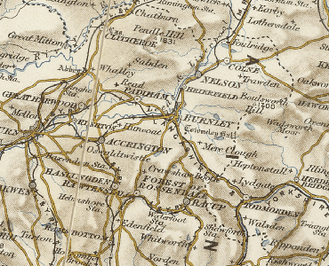 | ||
Habergham Eaves is a civil parish in the borough of Burnley, in Lancashire, England. The parish consists of a rural area south of Burnley, and suburban areas on the outskirts of the town, including a large industrial estate in the north-west corner of the parish. Habergham is also the name of an area west of Burnley, although it is no longer within the parish. According to the United Kingdom Census 2011, the parish has a population of 1,466, a decrease from 1,581 in the 2001 census. The A646 Padiham to Todmorden road runs approximately along the northern boundary of the parish. Surrounding areas include the unparished areas of Burnley and Rossendale, and the parishes of Hapton, Dunnockshaw and Clowbridge and Cliviger.
Map of Habergham Eaves, UK
Habergham Eaves was historically a township in the ancient parish of Whalley, extending further to the north from Gawthorpe Hall in the west to Towneley Hall in the east, the River Calder generally separating it from the neighbouring townships, and from 1861 the Borough of Burnley. However in 1894 a large part of the township, with a population of over 40,000 and including Rose Grove, Burnley Wood, Gannow and Habergham, was transferred to the County Borough of Burnley, and taken of the control of the newly established Lancashire County Council. The remainder, with the exception of a small area transferred to Ightenhill, became the civil parish of Habergham Eaves. under the governance of Lancashire and the Burnley Rural District. During World War II a Starfish site bombing decoy was constructed off Crown Point Road, part of a network designed to protect Accrington.