
Highest point Volcano Population 10 (2001) Elevation 180 m Capital Mykonos | Highest elevation 180 m (590 ft) Capital city Chora Postal code 853 03 Max length 6 km Area code 22420 | |
 | ||
Similar Göllü Dağ, Profitis Ilias, Sousaki volcano, Kolumbo, Newberry Volcano | ||
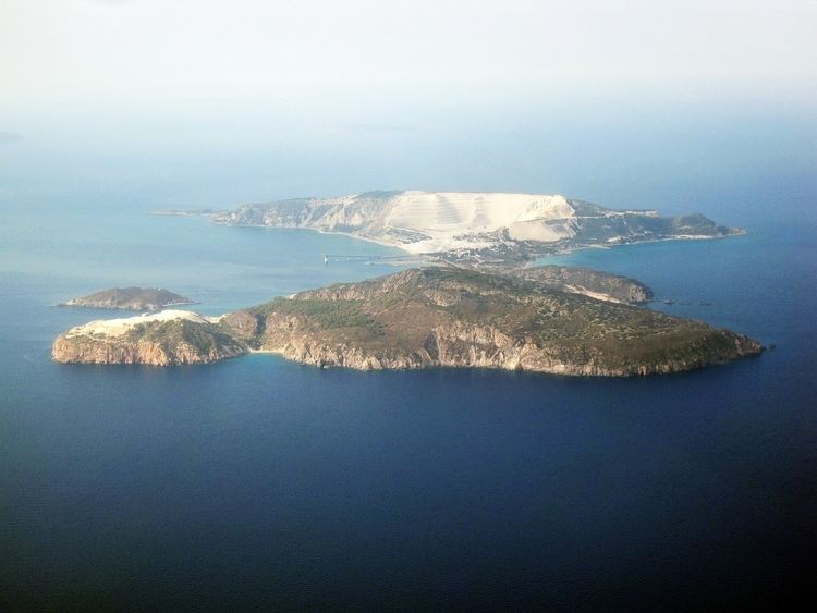
Gyali (Greek: Γυαλί "glass", also spelled Giali or Yali, pronounced [ʝaˈli]) is a volcanic Greek island in the Dodecanese, located halfway between the south coast of Kos (Kardamaina) and Nisyros. It consists of rhyolitic obsidian lava domes and pumice deposits (which are mined in huge quantities). The island has two distinct segments, with the northeastern part almost entirely made of obsidian and the southwestern part of pumice. These are connected by a narrow isthmus and beach made of modern reef sediments.
Contents
Map of Gyali, Nisiros, Greece
Geography
The island is 6 km (4 mi) long and between 4 km (2 mi) and 500 m (1,640 ft) across. It has a 180 m (591 ft) cave. Parts of the island undergoing pumice strip mining are barren of vegetation. The 2001 census reported a resident population of 10 people. Administratively, it is part of the municipality of Nisyros. Its also popular for Perli, a thermo powder added in construction.