
 | ||
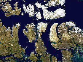
The Gulf of Boothia /ˈbuːθiə/ is a body of water in Nunavut, Canada. Administratively it is divided between the Kitikmeot Region on the west and the Qikiqtaaluk Region on the east. It merges north into Prince Regent Inlet, the two forming a single bay with different names for its parts. It is surrounded by, clockwise, Baffin Island, Fury and Hecla Strait, the Melville Peninsula, the Canadian mainland, the Boothia Peninsula and perhaps Bellot Strait if the Gulf can be said to extend that far north. The south end is Committee Bay, northwest of which are the Simpson Peninsula and Pelly Bay. In addition to its connection to Prince Regent Inlet one can use an icebreaker to go east through the Fury and Hecla Strait, or, with luck, pass the Bellot Strait westward.
Map of Gulf of Boothia, Kitikmeot, Unorganized, NU, Canada
In 1822 it was seen by some of William Edward Parry's men who went on foot along the ice-choked Fury and Hecla Strait. In 1829 it was entered by John Ross (Arctic explorer) who was frozen in for four years and named it for his patron Sir Felix Booth. Its south end was explored by John Rae (explorer) in 1846/47 who reached it overland from the south.