
Country India Language spoken • Official
Kannada Area 64 km2 | State Karnataka Region Bayaluseeme District Kalaburagi District | |
Colleges and Universities Gulbarga University, PDA College of Engineering, Khaja Banda Nawaz Institute of Medical Sciences, Mahadevappa Rampure Medical College, Luqman College of Pharmacy | ||
Gulbarga / Kalaburagi is a city in the Indian state of Karnataka. It is the administrative headquarters of the Kalaburagi District. Kalaburagi is 623 km north of the state capital of Bengaluru and 200 km from Hyderabad. Although initially part of Hyderabad State, it was incorporated into a newly formed Mysore State (now known as Karnataka) through the States Reorganisation Act in 1956. Kalaburagi is also famous for toordal & the limestone deposits are more in Kalaburagi District. It is called one of the Sufi city having famous religious places, like Bande Nawaz dargah and Ladle Mashak in aland taluk of kalaburagi dist. Every year during urs of hazrat bande nawaz people come from all India,far cities like Mumbai,hyderabad,lucknow,etc. and it has many other famous places like Sharana Basaveshwara Temple and buddha vihar.
Contents
- Map of Gulbarga
- Beautiful gulbarga bus terminal
- Sungunda village aland taluka gulbarga dist karnataka state
- History
- Geography
- Tourism
- Cuisine
- References
Map of Gulbarga
Beautiful gulbarga bus terminal
Sungunda village aland taluka gulbarga dist karnataka state
History
The recorded history of Kalaburagi dates back to the 6th century. The Rashtrakutas gained control over the area, but the Chalukyas regained their domain within a short period and reigned supreme for over two hundred years. The Kalaharis who succeeded them ruled until the 12th century. Around the end of the 12th century, the Yadavas of Devagiri and the Hoysalas of Dwarasamadra destroyed the supremacy of the Chalukyas and Kalachuris. Around the same period, the Kakatiya kings of Warangal came into prominence and the present Kalaburagi and Raichur districts formed part of their domain. The Kakatiya power was subdued in 1321 AD and the entire Deccan, including the district of Kalaburagi, passed under the control of the Emperors of Delhi.
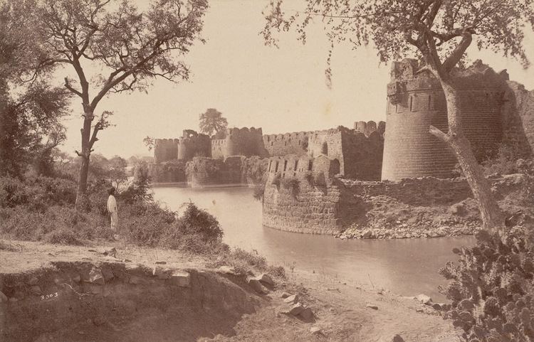
The revolt of the officers appointed from Delhi resulted in the founding of the Bahmani Sultanate in 1347 AD by Zafar KhanHasan Gangu, who chose Kalaburagi(called Ahasanabad during this period) to be the capital. When the Bahmani dynasty came to an end in 1428, the kingdom broke up into five independent Sultanates, Bijapur, Bidar, Berar, Ahmednager, and Golconda. The present Kalaburagi district came partly under Bidar and partly under Bijapur. The last of these sultanates, Golconda, finally fell to Aurangzeb in 1687.
With the conquest of the Deccan by Aurangezeb in the 17th century, Kalaburagi passed under the Mughal Empire. In the early part of the 18th century, with the decline of the Mughal Empire, Asaf Jha, one of Aurangzebs generals, formed the Hyderabad State, in which a major part of the Kalaburagi area was also included. In 1948, Hyderabad State became a part of the Indian Union, and in 1956, excluding two talukas which were annexed to Andhra Pradesh,Kalaburagi district became part of new Mysore State.
Gulbarga (Urdu) (city of flowers and gardens) was renamed Kalaburagi (Kannada) (Kala-Art/Bura-Bad, Strong Stone Fort) effective 1 November 2014
Geography
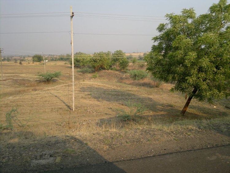
The entire district is situated on the Deccan Plateau, and the elevation ranges from 300 to 750 meters above MSL. Two main rivers, the Krishna and Bhima, flow through the district. The predominant soil type in the district is black soil. The district has a large number of tanks, which irrigate the land along with the river. The Upper Krishna Project is a major irrigation venture in the district of Jowar. The main crops are groundnuts, rice, and pulses. Kalaburagi is the largest producer of toor dal, or pigeon peas, in Karnataka. Gulbarga is an industrially backward district but is showing signs of growth in the cement, textile, leather and chemical industries.Kalaburagi has a university with Medical and Engineering Colleges.
Tourism
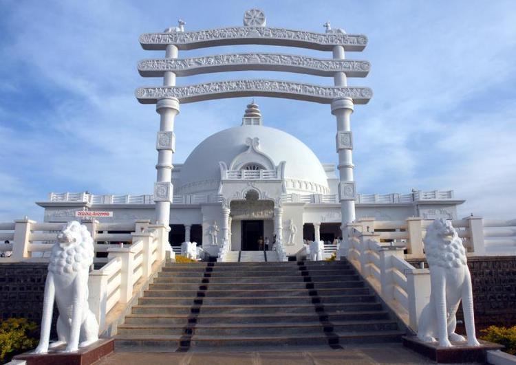
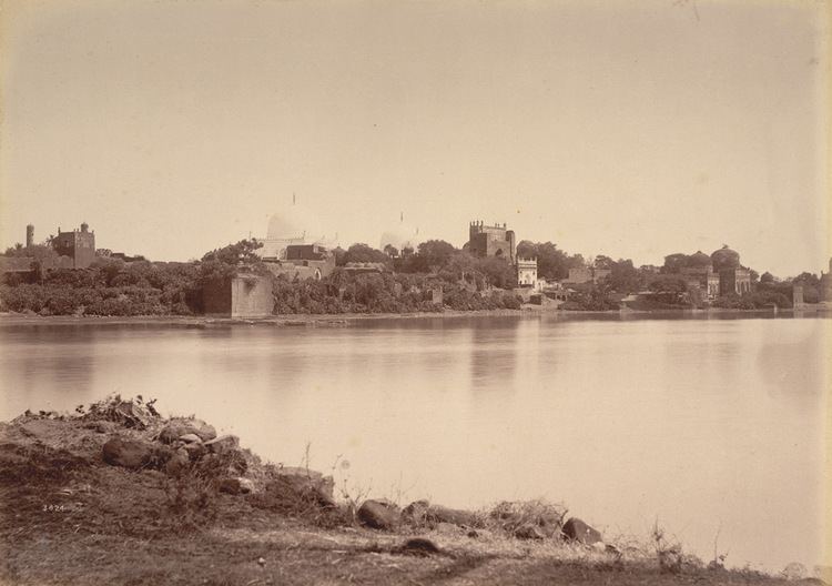
There are many different attractions located in Kalaburagi: Bahmani fort, Tomb of first Bahmani Sultan Hasan, Government Museum, Holkonda fort, Ferozabad fort, Sharanabasaveshwar Temple, Shri Kshetra Ganagapur (Ganagapur), a well-known pilgrimage site of the god Shri Sadguru Dattatreya Narasimha Saraswati, Sri. Hulakantheshwar Temple (Herur. B), and the Ghathargi Bhagayavanti Temple (Afzalpur Taluk), located on the bank of the Bhima River. Places of religious importance in Gulbarga include the Khwaja Bande Nawaz Dargah, Sharanabasaveshwar Temple, Buddha Vihar and Sheikh Roza Dargah. Devotees from all over the world visit these places of worship every year.
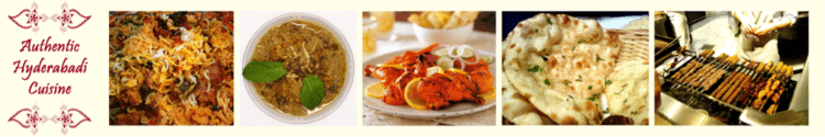
Cuisine

Jolada Rotti Jolada Rotti/Jowari Bhakri (known as sorghum in the western world) is the staple diet in the region. It is prepared from jowar flour. Jolada Rotti or Jwarichi Bhakri is served with traditional curries, especially Brinjal curry, and spiced groundnut powder and yogurt. Generally, the food in Gulbarga is considered very spicy when compared with the rest of the state.
Hoorana Holige A variant of Puran Poli of Maharashtra. This is a type of specialty sweet found only in Kalaburagi and prepared during any festivals. It is a kind of stuffed pancake. Chickpeas and Jaggery are grounded and stuffed into wheat flour and then cooked. This is served with mango pulp as a side dish.
Malpuri Malpuri is a dessert which is made of khoa.It is widely known in kalaburagi.