Population 145,706 (Jan 2016) | Municipality Taoyuan City Local time Sunday 1:09 AM | |
 | ||
Weather 19°C, Wind SE at 14 km/h, 96% Humidity Colleges and Universities Chang Gung University, Lunghwa University of Scienc, Chang Gung University, National Taiwan Sport Uni, Central Police University | ||
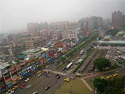
Guishan District (Chinese: 龜山區; pinyin: Guīshān Qū) is a rural district in northeastern Taoyuan City, Taiwan.
Contents
- Map of Guishan District Taoyuan City Taiwan 333
- History
- Geography
- Administrative divisions
- Government and infrastructure
- Education
- Infrastructure
- Tourist attractions
- Road
- Taipei Metro
- Taoyuan Airport MRT
- Taiwan Railways Administration
- References
Map of Guishan District, Taoyuan City, Taiwan 333
History
Guishan was formerly known as Kulunsia (Chinese: 龜崙社; Pe̍h-ōe-jī: Ku-lun-siā). The name originated from a hill by the Mercy Buddha Temple of Shou Shan Rock, built in 7th year of the Qianlong Period of the Qing Dynasty. The Plains Aborigines and Ketagalan tribes were located here.
From 1920 to 1945, Kameyama Village (龜山庄) was under Tōen District, Shinchiku Prefecture.
In 1950, it was renamed to Guishan. On 25 December 2014, it was upgraded into a district called Guishan District.
Geography
Administrative divisions
Jingzhong, Liuguang, Zhongxing, Xinxing, Xinlu, Guishan, Datong, Shanding, Shande, Shanfu, Xingfu, Longshou, Longhua, Huilong, Lingding, Xinling, Tukeng, Fuyuan, Jiulu, Dakeng, Fengshu, Leshan, Zhanggeng, Gongxi, Dagang, Dahu, Dahua, Wenhua, Nanshang and Nanmei Village.
Government and infrastructure
The Ministry of Justice operates Taipei Prison in Guishan.
