
Islands none Area 843 m² Outflow location Stillach | Max. width 0.025 km (0.016 mi) Surface elevation 1,709 m Shore length 119 m | |
 | ||
Surface area 0.000843 km (0.000325 sq mi) | ||
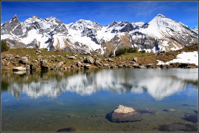
The Guggersee is a small mountain lake in the Southeastern Walsertal Mountains (Südöstliche Walsertaler Berge), a subgroup of the Allgäu Alps.
Map of Guggersee, 87561 Oberstdorf, Germany
It is located at a height of 1,709 metres, above the Rappenalpbach valley in the municipality of Oberstdorf. The lake lies 1,035 metres as the crow flies southwest of and below the Alpgundkopf (2,177 m) on a Panorama Way (Panoramaweg) between Birgsau in the valley and the Mindelheim Hut (2,013 m). On this path, 455 metres southwest at a height of 1,727 metres, is the alm of Vordere Tauferbergsalpe. From Birgsau the lake is about 2 hours walk.
The lake is 49 metres long and a maximum of 25 metres wide. It has a shore length of 119 metres and an area of around 843 m². Formerly it was up to 75 metres long, but the northern part has silted up.