
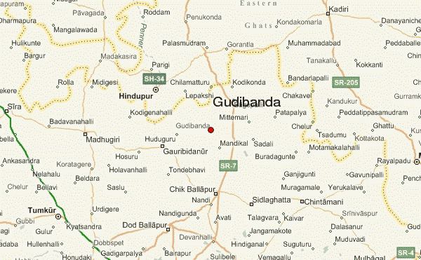
Country India District Chikkaballapur Elevation 826 m | State Karnataka Time zone IST (UTC+5:30) Population 8,794 (2001) | |
 | ||
Weather 32°C, Wind W at 10 km/h, 20% Humidity | ||
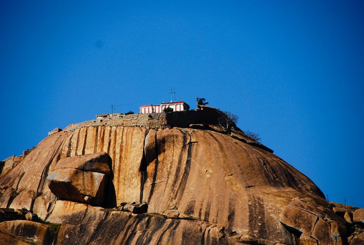
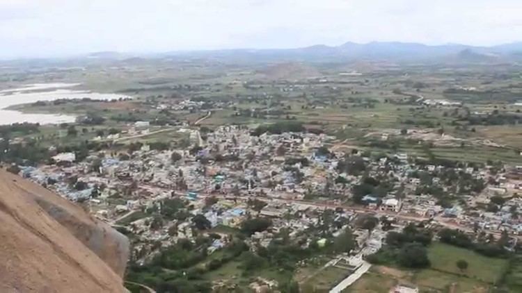
Gudibanda town view from gudibanda fort
Gudibande is a panchayat town in Chikkaballapur District in the Indian State of Karnataka.
Contents
- Gudibanda town view from gudibanda fort
- Geography
- Demographics
- Places to visit in Gudibande
- Directions
- Bloglinks
- Nearby villages
- References
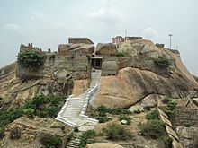
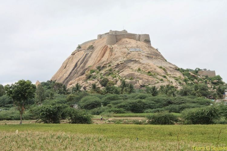
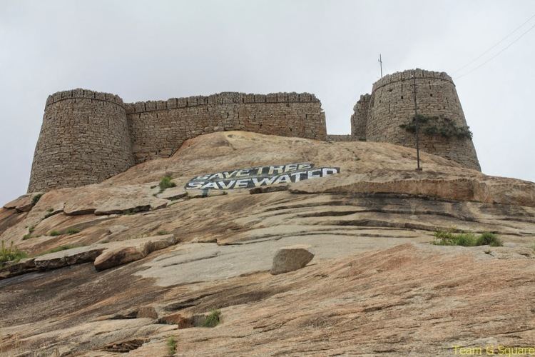
Gudibande Fort was built by local chieftain Byre Gowda some 400 odd years ago in the 17th century. It can be said as a concise replica of the Madhugiri fort. The fort has seven levels with interconnecting escape routes which would help soldiers to flee in case of emergency. On the top of the fort is a Shiva temple, which is believed to be one of the 108 Jyotirlingas. The strong pillar with a square base has well sculpted images. One can also have a good view of the Byrasagara reservoir. The fort’s main feature, is the rain water harvesting. It is said that there were around 19 rock ponds at different levels of the fort.
Geography
Gudibande is located at 13.67°N 77.7°E / 13.67; 77.7. It has an average elevation of 826 metres (2709 feet).
Demographics
As of 2001 India census, Gudibanda had a population of 8794. Males constitute 50% of the population and females 50%. Gudibanda has an average literacy rate of 62%, higher than the national average of 59.5%: male literacy is 69%, and female literacy is 56%. In Gudibanda, 12% of the population is under 6 years of age.
Places to visit in Gudibande
The Lakshmivenkataramanaswamy temple is one of the popular temples in Gudibanda which was constructed by Cholas.
Narasimhaswamy Temple is sort of a cave temple hewn out a huge rock [the name Gudibande to the town came this: gudi = temple, Banda = rock]
Surasadmagiri Hill and Amani Byrasagara Lake - Surasadmagiri Hill is the second highest hill in the District. The hill contains thirteen Ponds and two Temples of Lord Shiva and Goddess Parvathi. Amani Byrasagara Lake was constructed by Byre Gowda in the 16th Century.
Gudibanda fort - The fort dating back to the middle of the 17th century was built by a small-time chieftain Byregowda who was Robinhood of those times, known to loot the rich and help the poor.
Directions
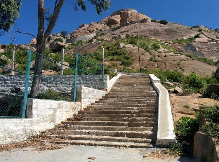
Gudibande is 100 km from Bengaluru (30 km from AP border).One can reach Gudibande by taking the Airport road. There are clear sign boards after Chikbalapur towards both left and right side of the road. The roads to the place throughout are in good condition and can be accessed with minor difficulty. It is a less known place for trekkies out there and slowly becoming popular over the past few years. The hill can be ascended in less than one hour. All climbers are advised to carry their food and replenishments as none is available on top.
Bloglinks
1. Gudibande Trek - Loapers
Nearby villages
Nicchanabandahalli (ನಿಚ್ಚನಬಂಡಹಳ್ಳಿ) ಗ್ರಾಮ.