
Primary inflows Basin countries Germany Surface elevation 55 m Outflow location Havel | Max. depth 32 metres (105 ft) Area 104 ha Inflow source Havel | |
 | ||
Surface area 1.04 square kilometres (0.40 sq mi) Similar Wangnitzsee, Drewensee, Labussee, Gobenowsee, Klenzsee | ||
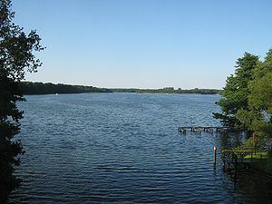
Großer Priepertsee is a lake in the Mecklenburg Lake District, in the German state of Mecklenburg-Vorpommern. It is in the district of Mecklenburgische Seenplatte.
Map of Gro%C3%9Fer Priepertsee, 17255 Priepert, Germany
The lake has an elevation of 54.9 metres (180 ft) and a surface area of 1.04 square kilometres (0.40 sq mi).
The navigable River Havel flows the length of the Großer Priepertsee, entering it directly from the connecting Wangnitzsee to the north, and leaving it at Priepert via a 0.6-kilometre (0.37 mi) long channel to the Ellbogensee to the south. Navigation is administered as part of the Obere–Havel–Wasserstraße.
References
Großer Priepertsee Wikipedia(Text) CC BY-SA