
Population 444 (2011) Groomsville Merritts CreekGeham | Postcode(s) 4352 State electorate(s) Nanango Postal code 4352 | |
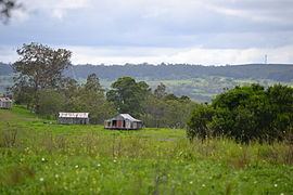 | ||
Groomsville is a locality in the Toowoomba Region local government area of the Darling Downs in southern Queensland, Australia. At the 2011 Australian Cenus Groomsville and surrounds recorded a population of 444. The area remains undeveloped.
Map of Groomsville QLD 4352, Australia
Part of the eastern and southwest boundary is marked by Cooby Creek. The creek flows into and out of Cooby Dam which occupies the southern extremities of Groomsville.
References
Groomsville, Queensland Wikipedia(Text) CC BY-SA