
Country Poland Car plates PGO Area 643.7 km² Capital Grodzisk Wielkopolski | Seat Grodzisk Wielkopolski Population 49,444 (2006) | |
 | ||
Gminas Total 5
Gmina Granowo
Gmina Grodzisk Wielkopolski
Gmina Kamieniec
Gmina Rakoniewice
Gmina Wielichowo Voivodeship Greater Poland Voivodeship Team Dyskobolia Grodzisk Wielkopolski Points of interest Wielkopolskie Muzeum Pożarnict, Muzeum Ziemi Grodziskiej, Park miejski, Grodziska Kolej Drezynowa | ||
Grodzisk Wielkopolski County (Polish: powiat grodziski) is a unit of territorial administration and local government (powiat) in Greater Poland Voivodeship, west-central Poland. It came into being on January 1, 1999, as a result of the Polish local government reforms passed in 1998. Its administrative seat and largest town is Grodzisk Wielkopolski, which lies 42 kilometres (26 mi) south-west of the regional capital Poznań. The county also contains the towns of Rakoniewice, lying 13 km (8 mi) south-west of Grodzisk Wielkopolski, and Wielichowo, 13 km (8 mi) south of Grodzisk Wielkopolski.
Contents
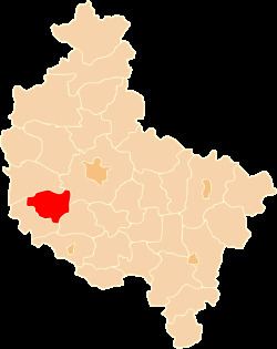
Map of Grodzisk Wielkopolski County, Poland
The county covers an area of 643.72 square kilometres (248.5 sq mi). As of 2006 its total population is 49,444, out of which the population of Grodzisk Wielkopolski is 13,703, that of Rakoniewice is 3,253, that of Wielichowo is 1,765, and the rural population is 30,723.
Neighbouring counties
Grodzisk Wielkopolski County is bordered by Poznań County to the east, Kościan County to the south-east, Wolsztyn County to the south-west and Nowy Tomyśl County to the west.
Administrative division
The county is subdivided into five gminas (three urban-rural and two rural). These are listed in the following table, in descending order of population.