
 | ||
Similar Großer Fallstein, Huysburg, Schloss Hessen, Colbitzer Lindenwald, Lappwald | ||
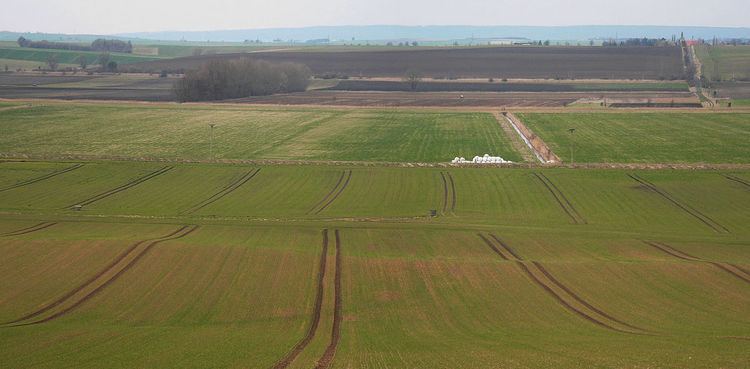
The Großes Bruch is a 45 kilometres (28 mi) long wetland strip in Germany, stretching from Oschersleben in Saxony-Anhalt in the east to Hornburg, Lower Saxony in the west.
Contents
The depression was formed from a glacial valley. The lowland meadow landscape with numerous reed- and willow-fringed ditches is one to four kilometres wide and runs along the Großer Graben and Schiffgraben ditches connecting the river valleys of the Bode in the east and Oker in the west.
History
Until the region began to be drained in the Middle Ages it was impassable, e.g. "in order to get to Hamersleben Abbey from the south, one has to use a ferry from the place where, today, the Neudamm is located and the village of Wegersleben (later Neuwegersleben)." The oldest building in Neudamm, a residential tower built of rubble stone, is thus called in Low German dat ole Fährhus ("the old ferryman's house"), an adjacent field is de Fährbrai and the road from Schwanebeck dä ole Fährweg ("the old ferry way").
According to legend, a ferryman, Eulunardus, in 1130 refused to ferry across the Saxon count palatine Frederick II of Sommerschenburg during a severe storm, and was therefore killed in a fit of violent temper. Out of remorse for his actions, Frederick confessed his murder to Abbot Siegfried of Hamersleben Abbey, gave the monastery a hide of farmland, supported the family of the victim with money and ensured that Bishop Rudolf of Halberstadt was able to build a strong dyke in 1137. The residential tower became a customs post as the Low German name oppen Tolly recalls. Also, the place name "Neudamm" ("new dyke") implies to the crossing of a wetland. The Hessen Dyke (Hessendamm), too, the metalled, western road across the Großes Bruch between Hessen and Mattierzoll recalls the construction of a medieval road that led through the Bruch and enabled grassland to be cultivated.
Drainage
The first drainage measures were carried out at the behest of the Halberstadt Prince-Bishops, who held the territory around Osterwieck south of the Großes Bruch. The Hessendamm was laid out by the Dukes of Brunswick-Lüneburg in order to reach their Hessen Castle outpost, which they had acquired from the comital House of Regenstein in 1343, from the northern side. Both rulers had the Großer Graben and Schiffgraben ditches laid out along the border of their Imperial State territories. The lands again became marshy in the Thirty Years' War, but were recultivated by the order of the "Great Elector" Frederick William of Brandenburg in his capacity as Prince of Halberstadt since 1648. His work was continued by the Prussian king Frederick the Great after the Seven Years' War.
By the 20th century irreparable damage was caused by large-scale, intensive farming. In order to create farmland, the groundwater level was lowered, grassland ploughed up and chemical fertilizer employed. The result was a loss of animal and plant species. Several regions dried out; in others water accumulated. After World War II the historical frontier between the former Halberstadt territory within the Prussian Province of Saxony (except for Hornburg and Roklum) in the south and the Brunswick lands (except for Hessen and Pabstorf) in the south along the Großes Bruch became the Inner German Border between West and East Germany. Increasing ecological understanding led in 1981 to the decision by the district council of Magdeburg, to place parts of the wetland, some 786 hectares, under protection.
After the German reunification in 1990, the entire Großes Bruch (6,000 hectares) was declared a protected landscape in order to conserve its fauna. The meadows are the residence and breeding areas of rare birds, including the hen harrier, Montagu's harrier, Eurasian curlew, short-eared owl, common snipe and corncrake. The little owl breeds in stands of pollarded willows.