
District Meißen Time zone CET/CEST (UTC+1/+2) Area 96.79 km² Population 19,977 (31 Dec 2008) | Elevation 122 m (400 ft) Postal codes 01558; 01561 Local time Saturday 12:39 AM Dialling code 03522 | |
 | ||
Weather 4°C, Wind W at 11 km/h, 81% Humidity Points of interest Heidehöhe, Heimatmuseum Alte Lateinschule, Richard Zschille Villa, Wallanlage | ||
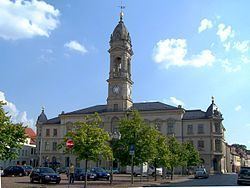
Großenhain (also written as Grossenhain; Upper Sorbian: Wulki Hojn) is a Große Kreisstadt (German for major district town) in the district of Meißen, Saxony, Germany.
Contents
Map of Grossenhain, Germany
History
Großenhain was originally a Sorb settlement. It was first mentioned in 1205. It was for a time occupied by the Bohemians, by whom it was strongly fortified. It afterwards came into the possession of the margraves of Meißen, from whom it was taken in 1312 by the margraves of Brandenburg. In the middle-ages, Großenhain was one of the most powerful towns in Saxony. It suffered considerably in all the great German wars, and in 1744 was nearly destroyed by fire. On May 16, 1813, a battle took place here between the French and the Russians.
Geography
Großenhain is located on the river Röder, 30 km (19 mi) northwest of Dresden, and 17 km (11 mi) east of Riesa. It is also situated on Via Regia from Görlitz to Santiago de Compostela.
Infrastructure
There are two train stations in Großenhain. As Großenhain Berliner Bahnhof is out of service since 2002, only Großenhain Cottbusser Bahnhof is served by trains from Dresden to Elsterwerda, Cottbus and Hoyerswerda.
Großenhain is accessible by car via Bundesstraße 98 and Bundesstraße 101.