
Elevation 528 m | Prominence 333 m | |
 | ||
Similar Barnacken, Großer Ahrensberg, Bloße Zelle, Großer Farmdenkopf, Hohe Egge | ||
At 527.8 m (1,732 ft) above sea level, the Große Blöße is the highest hill in the Solling-Vogler Nature Park, the Solling and the Weser Uplands (Lower Saxony, Germany).
Contents
Map of Gro%C3%9Fe Bl%C3%B6%C3%9Fe, 37170 Solling, Germany
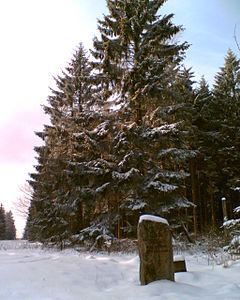
Despite its name, the summit is forested.
Geographical locationEdit
The thickly forested hill is located about 7 km (4 mi) (as the crow flies) southwest of Dassel between the villages of Hellental to the north and Silberborn to the south. It rises on the southeastern flank of the Helle Rift Valley (Hellentaler Graben), through which the River Helle flows. On the far, northwestern, side of this graben is the Großer Ahrensberg, the second highest hill in the Solling range.
Summit areaEdit
The L 549 country road runs just past the unassuming summit of the Große Blöße through dense woods. The road runs from Dassel via Silberborn and Neuhaus to Boffzen.