
GNIS feature ID 876803 Area code 201 | Elevation 19 m | |
 | ||
Restaurants Lin's Gourmet, Neptune Cafe, Vinnie's Pizza III, Laico's Restaurant, King Fried Chicken | ||
Greenville is an unincorporated community of Jersey City in Hudson County, New Jersey, United States. It makes up the southernmost section of the city.
Contents
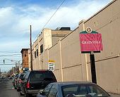
- Map of Greenville Jersey City NJ USA
- Minkakwa Kewan and Pamrapo
- Bergen Greenville Jersey
- 20th century
- 21st century
- Public transportation
- Links to articles related to Greenville
- References
Map of Greenville, Jersey City, NJ, USA
In its broadest definition Greenville encompasses the area south of the West Side Branch of Hudson-Bergen Light Rail and north of the city line with Bayonne, between the Upper New York Bay and the Newark Bay, and corresponds to the postal area zip code 07305. The Claremont Section straddles Greenville and Bergen-Lafayette.
The central core of Greenville (between Garfield Avenue and West Side Avenue) is primarily residential, the housing stock mostly one and two family homes and lowrise apartment buildings. Principal corridors include MLK Drive, Old Bergen Road and Danforth Avenue. This part of Greenville is home to the Afro-American Historical and Cultural Society Museum at the Greenville Branch of the Jersey City Public Library, Greenville Hospital, Jewish Hospital, Henry Snyder High School, and New Jersey City University all located on the district's main thoroughfare, Kennedy Boulevard. The Bayview - New York Bay Cemetery is a prominent landmark. The part of Greenville at the city line is known as Curries Woods. Greenville Hospital closed in 2008 was renovated and is now part of Barnabas Health which operates Jersey City Medical Center.
East of New Jersey Turnpike Newark Bay Extension (Interstate 78) lie the Greenville Yards, an intermodal facility, Port Jersey, Port Liberté, (a gated residential community), and the Caven Point Section of Liberty State Park. Slightly further inland and parallel to the route of the Turnpike, was that of the Morris Canal until abandoned in the 1920s. A small (filled-in) portion of the canal still exists in Country Village, a neighborhood near Droyer's Point and the West Side.
Besides nearby Liberty State Park other parks include Mercer Park, Bayside, Columbia, and Fricchione. Cochrane Athletic Field is located near the Hudson Waterfront. Audubon Park is a city square.
Minkakwa, Kewan, and Pamrapo
What became Greenville was the territory of the Hackensack and Raritan Indians at the time of European contact in the 17th century. They called the area on Bergen Neck Minkakwa (alternatively spelled Minelque and Minackqua) meaning a place of good crossing. This is likely so because it was the most convenient pass between the two bays on either side of the neck. Interpreted as place where the coves meet, in this case where they are closest to each, it describes a spot advantageous for portage. First settled by New Netherlanders in 1647. the Caven Point settlement on the west shore of the Upper New York Bay between Pamrapo and Communipaw was part of Pavonia, which, upon receiving its municipal charter in 1661 was renamed Bergen. The name Caven is an anglicisation of the Dutch word Kewan, which in turn was a "Batavianized" derivative of an Algonquian word meaning peninsula.
Bergen, Greenville, Jersey
During the British and early American colonial era the area was part of Bergen Township. The 19th century Jersey City and Bergen Point Plank Road (today's Garfield Avenue) ran through Greenville (from Paulus Hook to Bergen Point). Greenville became part of the newly formed Hudson County in 1840. The town grew as a fashionable suburb of New York City.Greenville Township was incorporated as a township by an Act of the New Jersey Legislature on April 14, 1863, from portions of Bergen Town. It was absorbed into Jersey City on February 4, 1873, ending its life as an independent municipality.
20th century
Greenville was settled by many working class Irish Catholic families, as well as other ethnic groups. The neighborhood's demographics changed dramatically starting in the 1950s, sixties and seventies, with the decline of factories and collapse of the independent railroad lines. Today, the area east of Kennedy Boulevard is heavily black, while the area west of Kennedy Boulevard is more diverse. Greenville also has a sizeable Hispanic population and many of the older white residents remain in the neighbourhood.
21st century
In 2005, due to a huge surge in murders and crime the city enacted a curfew for business owners on some of Greenville's most crime-ridden streets, including Martin Luther King Drive and Ocean Avenue. Most of the 39 murders in 2005 occurred within the borders of this Jersey City neighborhood. Many drug gangs and street gangs have staked out their territories along this neighborhood's most blighted street, and in 2005 the FBI targeted a group of drug dealers that were entrenched on the corner of Lexington and Bergen Avenues, the base of operations for cocaine distribution and an area where numerous drug- and gang-related murders and shootings had taken place between 1993 and 2002.
While the neighborhood has a reputation for urban decay, there are many intact streets, long-term residents and businesses.
Public transportation
The Richard Street and Danforth Avenue stations of the Hudson-Bergen Light Rail are located on the district's east side east of Garfield Avenue, while West Side Branch Hudson-Bergen Light Rail stations (including the MLK Station) are on its northern perimeter, which overlaps Bergen-Lafayette. There is bus service along its north south-streets avenues: Ocean Avenue, Old Bergen Road, Kennedy Boulevard, and West Side Avenue operated by New Jersey Transit buses to Journal Square, Exchange Place, and Bayonne, the Red & Tan buses 99s and 4. The Greenville Bus Garage on Old Bergen Road is one of the largest in Hudson, housing more than 120 buses for Routes: 6, 43, 80, 81, 87, 120, 126, 99.