
Country United States County Milwaukee Time zone Central (CST) (UTC-6) Population 14,340 (2013) | State Wisconsin Elevation 738 ft (225 m) Area code(s) 414 Local time Thursday 7:49 PM | |
 | ||
Weather 1°C, Wind NW at 6 km/h, 49% Humidity Points of interest Trimborn Farm, Scout Lake Park, Historic Greendale Welcome, Historical Marker 279: Wisc, Historical Marker 460: Villa | ||
Greendale wisconsin
Greendale is a village in Milwaukee County, Wisconsin, United States. The population was 14,046 at the 2010 census. Greendale is located southwest of Milwaukee, Wisconsin, and is a part of the Milwaukee metropolitan area.
Contents
- Greendale wisconsin
- Map of Greendale WI USA
- History
- Geography
- 2010 census
- Historic places
- Education
- Recreation
- Commerce
- Notable people
- References
Map of Greendale, WI, USA
Greendale wisconsin
History
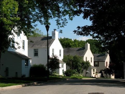
Greendale was one of three "Greenbelt" communities constructed by the U.S. Department of Agriculture, starting in 1936, as a part of President Franklin Roosevelt's New Deal. The communities were built to demonstrate a new kind of suburban living, with housing situated within easy walking distance of gardens, employment and the town center. The other Greenbelt communities were Greenbelt, Maryland and Greenhills, Ohio. The communities were designed with three goals in mind: to combine the advantages of city and country life; to provide good housing at reasonable prices for moderate income families; and to provide jobs to unemployed workers.
All of the property was owned by the government and rented to families based on income, housing need and family size. Some exceptions were made for those with special skills, such as medical doctors and other professionals. In 1949 the Public Housing Administration gave Greendale residents the right to purchase their homes from the government. The transfer of ownership from the government to the people was largely complete by 1952.
In 1996, the shopping district in the center of the village was purchased by the Grandhaven investment firm founded by Roy Reiman, founder of a publishing company headquartered in the village. The remake of the "Village Center" brought updates, attracted new restaurants, and made the village center more of a tourist attraction.
Geography
Greendale is located at 42°56′15″N 87°59′49″W (42.937615, -87.996884). The Root River flows through the western part of the village.
According to the United States Census Bureau, the village has a total area of 5.57 square miles (14.43 km2), of which, 5.56 square miles (14.40 km2) of it is land and 0.01 square miles (0.03 km2) is water.
2010 census
As of the census of 2010, there were 14,046 people, 6,075 households, and 4,016 families residing in the village. The population density was 2,526.3 inhabitants per square mile (975.4/km2). There were 6,294 housing units at an average density of 1,132.0 per square mile (437.1/km2). The racial makeup of the village was 92.8% White, 1.2% African American, 0.4% Native American, 3.1% Asian, 0.9% from other races, and 1.6% from two or more races. Hispanic or Latino of any race were 4.7% of the population.
There were 6,075 households of which 28.0% had children under the age of 18 living with them, 52.5% were married couples living together, 10.0% had a female householder with no husband present, 3.6% had a male householder with no wife present, and 33.9% were non-families. 30.1% of all households were made up of individuals and 17% had someone living alone who was 65 years of age or older. The average household size was 2.31 and the average family size was 2.87.
The median age in the village was 45.3 years. 22.1% of residents were under the age of 18; 5.6% were between the ages of 18 and 24; 21.7% were from 25 to 44; 28.2% were from 45 to 64; and 22.2% were 65 years of age or older. The gender makeup of the village was 46.6% male and 53.4% female.
Historic places
The Greendale Historic District was added to the National Register of Historic Places in 2005 and designated a National Historic Landmark in 2012. Trimborn Farm, also on the National Register of Historic Places, is in Greendale.
Education
The village has one public high school, one public middle school, and three public elementary schools. Greendale High School was named by Newsweek as one of America’s Best High Schools in its 2009 & 2010 rankings. In 2007 the Greendale School District was ranked by Milwaukee Magazine as the top school system among the Milwaukee metropolitan area. Martin Luther High School is a private high school in the village.
Recreation
Part of the Root River Parkway is in Greendale. Whitnall Park, which is the largest park in Milwaukee County. borders Greendale on the western boundary of the village. Whitnall Park offers many recreation options, including an 18-hole golf course, many hiking, biking and cross-country ski trails, the Wehr Nature Center and the Boerner Botanical Gardens.
Commerce
The largest mall in Wisconsin, Southridge Mall, is located in Greendale. The mall has over 125 stores, including the major department stores Boston Store, jcpenney, Kohl's, Sears and Macy's. The nearby downtown village center has more than a dozen independent shops and six restaurants that cater to tourists and locals alike.