
OS grid reference TF850015 Dialling code 01760 | Sovereign state United Kingdom Area 9.84 km² | |
 | ||
Population 279 (2001 census)421 (2011) | ||
Great Cressingham is a village which lies about 5 miles (8.0 km) of Watton, 6 miles (9.7 km) south of Swaffham and only 1.5 miles (2.4 km) off the A1065 arterial road just north of Hilborough. It is 2.5 miles (4.0 km) north west by road from Little Cressingham. In 2007 it had an estimated population of 235, in an area of 9.84 km2 (3.80 sq mi), including Little Cressingham and increasing to 421 at the 2011 Census.
Map of Great Cressingham, UK
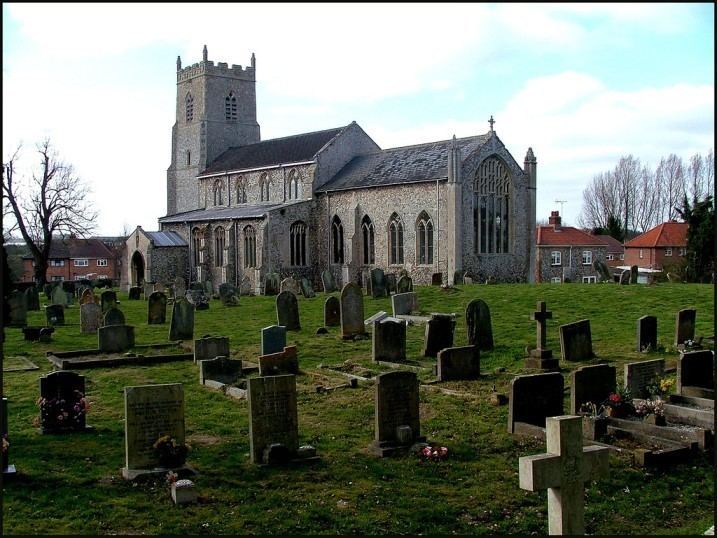
The village church is dedicated to Saint Michael in the Benefice of Cockley Cley
There is a pub called the Olde Windmill Inn.
The village school was built in 1840. It was used as a local Authority school until 1992 and was then acquired by Tom and Sally North. They have restored it as closely as possible to how it would have been in Victorian times and now run free historical school days.
Great Cressingtham is on the very edge of the Stanford Battle Area.