
Country United States Area code(s) 502 Zip code 40327 Population 77 (2013) | Time zone Eastern (EST) (UTC-5) Elevation 137 m Local time Saturday 1:05 PM | |
 | ||
Named for the grandson of Sen. John Brown Weather 6°C, Wind W at 24 km/h, 64% Humidity | ||
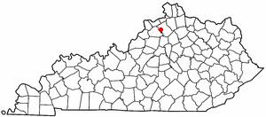
Gratz is a 6th-class city in Owen County, Kentucky, in the United States. The population was 89 at the 2000 census.
Contents
Map of Gratz, KY 40359, USA
History
The local post office was established in 1844 as Clay Lick from its position above Clay Lick Creek. The present city was laid out in 1847 on land supposedly owned by the heirs of Sen. John Brown and was probably named for his grandson B. Gratz Brown, who later became a senator from and governor of Missouri and made a failed vice-presidential bid in 1872 with Horace Greeley of the Liberal Republicans.
The town was incorporated in either 1861 or 1881.
Before the lock and dam system was built on the Kentucky River, Gratz was one of the most prosperous towns in the area due to the business of portaging goods around an unnavigable part of the river (Lock #2 is just up river at Lockport). Goods were also ferried across the river and transported up KY 22 to Pleasureville, which had a railroad depot.
The town's streets are laid out in a grid pattern. There is a local bank, and many large, well-built houses. Before public electric service was available, a diesel powered generator fed street lights (and some homes?) from dusk until about 10pm. A former operator of this plant reported that he learned how much fuel to put into the engine so that it would run out at the desired time (saved him a trip down the hill).
It is home to the only bridge between Frankfort and Carrollton along the Kentucky River. The Gratz Bridge is a historic iron steel bridge built back in the 1930s. Work on a newer concrete bridge was set in 2009, with it being finished by late 2010. Demolition of the old bridge is set to follow after in 2011. The Gratz Bridge is on the National Register of historic landmarks.
Geography
Gratz is located at 38°28′28″N 84°57′10″W (38.474448, -84.952653).
According to the United States Census Bureau, the city has a total area of 0.3 square miles (0.78 km2), all land.
Demographics
As of the census of 2000, there were 89 people, 35 households, and 24 families residing in the city. The population density was 255.8 people per square mile (98.2/km²). There were 43 housing units at an average density of 123.6 per square mile (47.4/km²). The racial makeup of the city was 94.38% White, 5.62% from other races. Hispanic or Latino of any race were 5.62% of the population.
There were 35 households out of which 28.6% had children under the age of 18 living with them, 60.0% were married couples living together, 2.9% had a female householder with no husband present, and 31.4% were non-families. 28.6% of all households were made up of individuals and 5.7% had someone living alone who was 65 years of age or older. The average household size was 2.54 and the average family size was 3.17.
In the city, the population was spread out with 24.7% under the age of 18, 13.5% from 18 to 24, 30.3% from 25 to 44, 20.2% from 45 to 64, and 11.2% who were 65 years of age or older. The median age was 33 years. For every 100 females there were 154.3 males. For every 100 females age 18 and over, there were 123.3 males.
The median income for a household in the city was $14,167, and the median income for a family was $23,750. Males had a median income of $16,250 versus $20,750 for females. The per capita income for the city was $9,217. There were 12.5% of families and 28.0% of the population living below the poverty line, including 40.0% of under eighteens and none of those over 64.