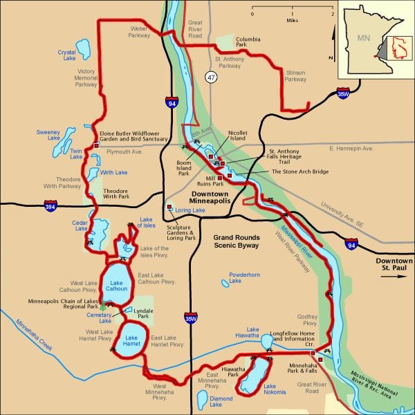
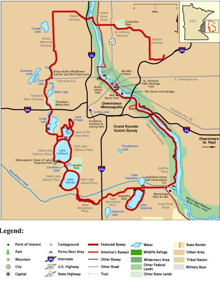
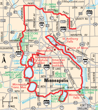
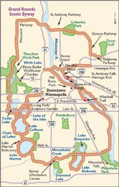
The Grand Rounds National Scenic Byway is a linked series of park areas in Minneapolis, Minnesota that takes a roughly circular path through the city. The corridors include roads for automobile traffic plus paths for pedestrians and bicycles, and extend slightly into neighboring cities. About 50 miles (80 km) of roadway is in the system, and much of it was built in the 1930s as part of Civilian Conservation Corps projects. There are seven districts along the byway:
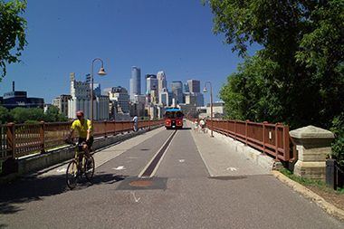
Mississippi River gorge area extends from downtown Minneapolis to Minnehaha Park. The Byway follows West River Parkway, and passes the west bank of the University of Minnesota. Several bridges connect the Byway with trails on the east bank, in both Minneapolis and Saint Paul.
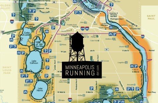
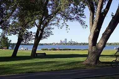
The Chain of Lakes including Lake Harriet, Lake Calhoun, Lake of the Isles, Cedar Lake, Brownie Lake, Lyndale Park and Lyndale Farmstead Park. The lake parkland is collectively the Minneapolis Chain of Lakes Regional Park. The Byway follows multiple intersecting paths: surrounding lakes are the counter-clockwise one-way Lake Harriet and Lake of the Isles Parkways, and the two-way Lake Calhoun Parkway; Cedar Lake Parkway runs along the western shore of that lake, and William Berry Parkway and Dean Parkway connect the circular lake parkways.
Theodore Wirth (extending into Golden Valley) consists of Theodore Wirth Park. The byway follows Cedar Lake Parkway as it crosses Interstate 394 and becomes Theodore Wirth Parkway. Heading north, it passes the Eloise Butler Wildflower Garden and Wirth Lake. Crossing Olson Memorial Highway, the Parkway enters Theodore Wirth Golf Course.
Victory Memorial includes the northwestern edge of Minneapolis. The byway follows Victory Memorial Parkway, which commemorates the contributions of people from Hennepin County in World War I. Victory Memorial Parkway becomes Weber Parkway. The Byway follows the Camden Bridge across the Mississippi River, which marks the head of navigation for barge traffic on the river.
Northeast runs through Northeast Minneapolis. The Byway follows St Anthony Parkway to Stinson Parkway, and follows that road south to Ridgway Parkway. It passes Columbia Park and Deming Heights Park, and terminates at Francis Gross Golf Course.
The area was designated as a Minnesota State Scenic Byway in 1997 and a National Scenic Byway in 1998. The Grand Rounds are considered to be the most significant example of an urban byway, as most such areas run through rural regions. Portions are also part of the Great River Road along the Mississippi River.
Fortuitously, the city bought up all the land immediately adjoining its lakes during its formative period, turning them into public parks rather than allowing them to be privately developed. Because of this, Minneapolis' lakes are open to all.
Heavy vehicles such as semi-trailer trucks and buses are largely banned from the byway, and the speed limit is 25 miles per hour throughout. Thanks to the low speed limit, motorcycle riders enjoy riding through the parkway system. Much of the asphalt paving along the road has a reddish tone so that drivers can more easily determine where to go upon reaching intersections.