
Area 54.63 km² | Established 1990 | |
 | ||
Management United States Forest Service Similar Laughing Whitefish Falls Sce, Meridian‑Baseline State Park, Coldwater Lake State Park, Harbor Island National, Baraga State Park | ||
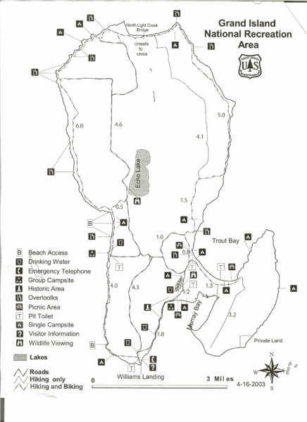
The Grand Island National Recreation Area is a National Recreation Area within the jurisdiction of the U.S. Forest Service. It is part of the Hiawatha National Forest. Located on Grand Island, Michigan offshore from Munising, Michigan, the Grand Island National Recreation Area covers approximately 13,500 acres (55 km2) of Lake Superior woodland. Grand Island's glacier-cut lake shoreline measures approximately 35 miles (56 km) in length. The island's maximum dimension is 8 miles (13 km) from north to south. Grand Island was elevated to the status of a National Recreation Area by the U.S. Congress in 1990 after the U.S. Forest Service purchased the island from its former owner, Cleveland Cliffs Iron Co.
Contents
Lake Superior
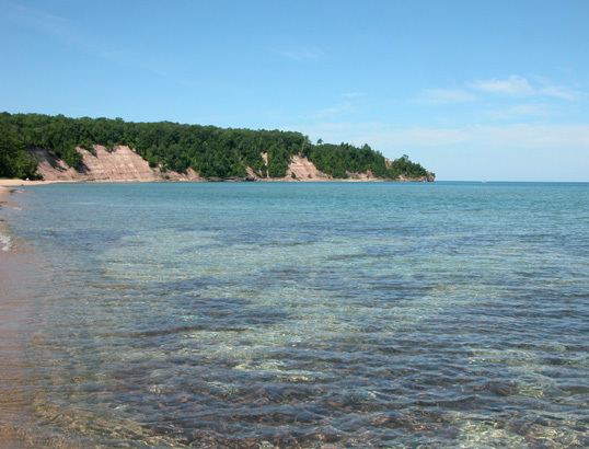
Lake Superior dominates the Grand Island biotic environment. Even in high summer, the lake's temperature rarely rises above 48 °F (9 °C).
Geology
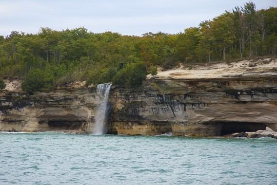
Grand Island's geology is an extension of the sandstone strata of the adjacent Pictured Rocks National Lakeshore. Island sandstone cliffs as tall as 300 feet (91 m) in height plunge down into the lake. A 23-mile (37 km) perimeter trail skirts much of the island's shoreline.
History
Native Americans quickly found the fisheries around Grand Island to be a resource for seasonal and year-round living. Artifacts from as early as 3300 years before the present (1300 BCE) have been found.
Tourism
Grand Island National Recreation Area is served during summer months by a tourist ferry and island tour bus. The ferry ride, which is less than 1 mile (1.6 km) long, shuttles between a dock on M-28, northwest of Munising, and Grand Island's Williams Landing. Ticket fees and an admission fee to the island are charged. During the summer months, the ferry makes several trips to the island each day.
A small portion of Grand Island, the Thumb, remained privately owned as of 2012. The Thumb contains a historic lighthouse, the 1868 Grand Island Harbor Light or 'East Channel Light', on the eastern ship channel from Lake Superior into the port of Munising. The lighthouse remained in operation until 1913. The privately owned lighthouse can be viewed from Sand Point, within the Pictured Rocks National Lakeshore or may be viewed from the water.
Recreational opportunities
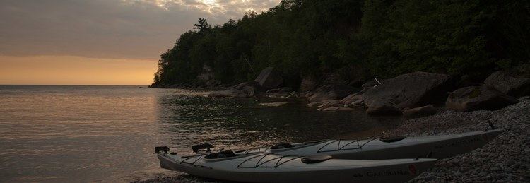
The U.S. Forest Services recommends that visitors enjoy camping, fishing, hiking, hunting, mountain biking, and trapping on Grand Island, subject to state license laws. There are 17 campsites within the Grand Island NRA. The largest animal with a breeding presence on the island is the black bear, from which campers must protect themselves.
Mountain biking is banned in most of the Thumb. Rockclimbing is strongly discouraged because the island's dramatic sandstone cliffs are friable and crumbly.
The Grand Island Trail Marathon has been held every July since 2005. The event also features a 10K race.