
Elevation 1,534 m | Parent range Jura Mountain range Jura Mountains | |
 | ||
Similar Signal du Mont du Chat, Semnoz, Vuache, Crêt de la Neige, Mont Colombier | ||
Grand Colombier (el. 1534 m) is a mountain in the Ain department in eastern France.
Map of Grand Colombier, 01260 Virieu-le-Petit, France
It lies in the area of Bugey.
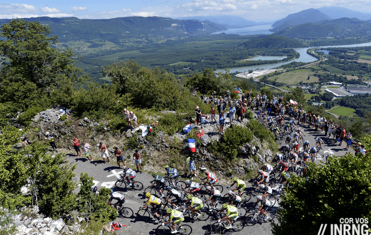
This summit dominates the upper valley of the Rhône and the Lake of Bourget in the Savoie department and the commune of Culoz which lies at its feet. From the Grand Colombier, hiking and mountain biking trails lead over the mountains of Bugey in the direction of the plateau of Retord. They offer a spectacular view of the Alps. The Col du Grand Colombier is one of the most difficult passes in France, with a 20-percent grade on the Bugey side.
References
Grand Colombier (Ain) Wikipedia(Text) CC BY-SA