
Built 1895 NRHP Reference # 85003271 Area 4 ha | MPS Brookline MRA Opened 1895 Added to NRHP 17 October 1985 | |
 | ||
Location Roughly bounded by Abbottsford Rd., Babcock St., Manchester, and Naples Rds., Brookline, Massachusetts Architect Greenleaf and Cobb,et al. Architectural style Colonial Revival, Queen Anne Similar Larz Anderson Auto Mus, Temple Ohabei Shalom, Coolidge Corner Theatre, Church of Our Saviour, Holyhood Cemetery | ||
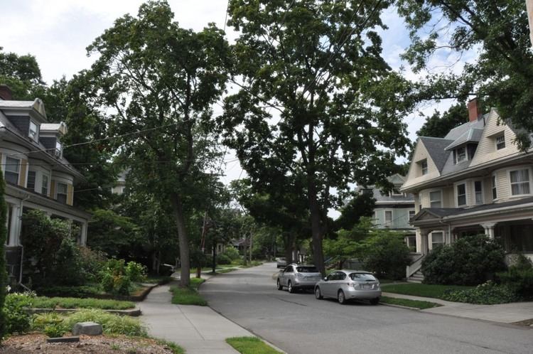
The Graffam Development Historic District encompasses the best-preserved portion of a historic residential subdivision, platted and built between 1894 and 1907. The land was purchased by Peter Graffam, who built a variety of Queen Anne and Colonial Revival houses on Babcock Street, Abbottsford Road, Manchester Road, Stedman Street, and Naples Road in Brookline, Massachusetts. Graffam also developed Osborne Street, but most of its houses have since been modified, losing historic integrity. The district was listed on the National Register of Historic Places in 1985.
References
Graffam Development Historic District Wikipedia(Text) CC BY-SA