
Country United States FIPS code 19-31845 Elevation 235 m Population 79 (2013) | Time zone Central (CST) (UTC-6) GNIS feature ID 0457010 Area 36 ha Local time Friday 8:06 PM | |
 | ||
Weather 6°C, Wind W at 31 km/h, 64% Humidity | ||
Graf is a city in Dubuque County, Iowa, United States. It is part of the 'Dubuque, Iowa Metropolitan Statistical Area'. The population was 79 at the 2010 census, up from 73 at the 2000 census.
Contents
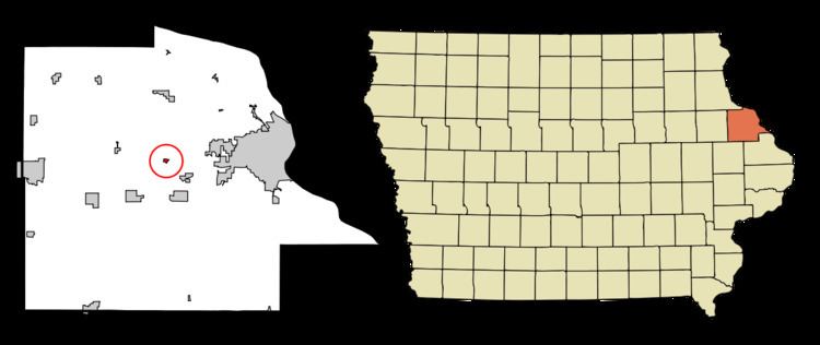
Map of Graf, IA 52039, USA
Geography
Graf is located at 42°29′42″N 90°52′19″W (42.494967, -90.872077).
According to the United States Census Bureau, the city has a total area of 0.14 square miles (0.36 km2), all of it land.
2010 census
As of the census of 2010, there were 79 people, 29 households, and 24 families residing in the city. The population density was 564.3 inhabitants per square mile (217.9/km2). There were 30 housing units at an average density of 214.3 per square mile (82.7/km2). The racial makeup of the city was 100.0% White. Hispanic or Latino of any race were 1.3% of the population.
There were 29 households of which 44.8% had children under the age of 18 living with them, 79.3% were married couples living together, 3.4% had a female householder with no husband present, and 17.2% were non-families. 17.2% of all households were made up of individuals and 6.8% had someone living alone who was 65 years of age or older. The average household size was 2.72 and the average family size was 3.08.
The median age in the city was 34.7 years. 29.1% of residents were under the age of 18; 2.6% were between the ages of 18 and 24; 31.6% were from 25 to 44; 29.1% were from 45 to 64; and 7.6% were 65 years of age or older. The gender makeup of the city was 55.7% male and 44.3% female.
2000 census
As of the census of 2000, there were 73 people, 23 households, and 22 families residing in the city. The population density was 521.4 people per square mile (201.3/km²). There were 23 housing units at an average density of 164.3 per square mile (63.4/km²). The racial makeup of the city was 100.00% White.
There were 23 households out of which 56.5% had children under the age of 18 living with them, 78.3% were married couples living together, 4.3% had a female householder with no husband present, and 4.3% were non-families. 4.3% of all households were made up of individuals and 4.3% had someone living alone who was 65 years of age or older. The average household size was 3.17 and the average family size was 3.23.
In the city, the population was spread out with 30.1% under the age of 18, 11.0% from 18 to 24, 26.0% from 25 to 44, 26.0% from 45 to 64, and 6.8% who were 65 years of age or older. The median age was 34 years. For every 100 females there were 97.3 males. For every 100 females age 18 and over, there were 121.7 males.
The median income for a household in the city was $56,250, and the median income for a family was $56,250. Males had a median income of $35,000 versus $24,250 for females. The per capita income for the city was $14,438. None of the population and none of the families were below the poverty line.