
Area 36 km² Established 1909 | Governing body Naturvårdsverket | |
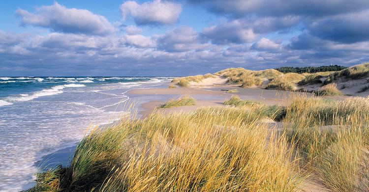 | ||
Gotska sando n juli 2015
Gotska Sandön (literally translated as Gotlandic Sand Island) is an uninhabited Swedish island, since 1909 also a national park, situated 38 km (24 mi) north of Fårö in the Baltic Sea. Legally a part of Gotland province, it is approximately 9 km (5.6 mi) long and 6 km (3.7 mi) wide, with a total area of approximately 36 km2 (14 sq mi). The island consists mostly of sand and is dominated by beaches, dunes and especially pine forests. Aside from a colony of grey seals, the higher fauna is not very rich. However, the island is home to many rare insects and plants, including the Kashubian vetch and several species of orchid. During the summer, there are regular boat tours from Fårö Island and Nynäshamn on the mainland.
Contents
- Gotska sando n juli 2015
- Map of Gotska SandC3B6n 624 65 FC3A5rC3B6sund Sweden
- Gotska sand n
- ClimateEdit
- References
Map of Gotska Sand%C3%B6n, 624 65 F%C3%A5r%C3%B6sund, Sweden
Gotska sand n
ClimateEdit
Despite its isolation from sizeable landmasses, Gotska Sandön's oceanic climate is warm for its latitude. The Scandinavian Peninsula to the west contributes to warmer summers and frequent winter frost, giving the island a far broader temperature range than, for example, the similarly isolated Fair Isle, which lies one degree further north some distance off the coast of Scotland. In spite of this range, summer highs are cool by the standards of southern Sweden, and winter nights are among the mildest in the country.
Gotska Sandön has significant seasonal lag: despite dwindling daylight hours, August is much warmer than June, while March days are both longer and colder than those in December.