
Work settlements 1 Area 1,483 km² | Towns of district significance 2 Selsoviets 9 | |
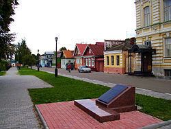 | ||
Points of interest Muzey Samovarov, Local Lore Museum, Detskiy Muzey Na Kupecheskoy, Dom Grafini Paninoy, Gorodetskiy Val | ||
Gorodetsky District (Russian: Городе́цкий райо́н) is an administrative district (raion), one of the forty in Nizhny Novgorod Oblast, Russia. Municipally, it is incorporated as Gorodetsky Municipal District. It is located in the west of the oblast. The area of the district is 1,473.7 square kilometers (569.0 sq mi). Its administrative center is the town of Gorodets. Population: 91,577 (2010 Census); 64,700 (2002 Census); 69,451 (1989 Census). The population of Gorodets accounts for 33.5% of the district's total population.
Contents
Map of Gorodetsky District, Nizhny Novgorod Oblast, Russia
History
The district was established in 1929.
References
Gorodetsky District Wikipedia(Text) CC BY-SA