
Coat of arms Flag Federal subject Mari El Republic Rural okrugs 10 Area 1,971 km² | Rural localities 241 | |
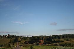 | ||
Gornomariysky District (Russian: Горномари́йский райо́н; Meadow Mari: Курыкмарий кундем; Hill Mari: Кырык мары кымдем) is an administrative and municipal district (raion), one of the fourteen in the Mari El Republic, Russia. It is located in the west of the republic and is the only district on the right bank of the Volga River. It borders with Yurinsky District in the north, Kilemarsky District and the Chuvash Republic in the south, and with Nizhny Novgorod Oblast in the west. The area of the district is 1,730 square kilometers (670 sq mi). Its administrative center is the town of Kozmodemyansk (which is not administratively a part of the district). As of the 2010 Census, the total population of the district was 25,869.
Contents
- Map of Gornomariyskiy r n Mari El Republic Russia
- Administrative and municipal status
- Demographics
- References
Map of Gornomariyskiy r-n, Mari El Republic, Russia
Administrative and municipal status
Within the framework of administrative divisions, Gornomariysky District is one of the fourteen in the republic. It is divided into 10 rural okrugs, comprising 241 rural localities. The town of Kozmodemyansk serves as its administrative center, despite being incorporated separately as a town of republic significance—an administrative unit with the status equal to that of the districts.
As a municipal division, the district is incorporated as Gornomariysky Municipal District. Its ten rural okrugs are incorporated as ten rural settlements within the municipal district. The town of republic significance of Kozmodemyansk is incorporated separately from the district as Kozmodemyansk Urban Okrug, but serves as the administrative center of the municipal district as well.
Demographics
The district is a home of Hill Mari people, and the Hill Mari language is spoken there.