
Length 10 mi (16 km) Season Year-round | ||
 | ||
Use Biking, hiking, in-line skating, cross-country skiing Sights Richard J. Dorer Memorial Hardwood State Forest: Hay Creek Unit, North Fork Zumbro River, Zumbrota Covered Bridge Trailheads | ||
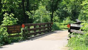
The Goodhue Pioneer State Trail is a multi-use recreational rail trail in southeastern Minnesota, USA. The 10 miles (16 km) of trail currently exist in two segments, separated by a 6-mile (9.7 km) gap. The 4-mile (6.4 km) northern segment is a paved trail running from Red Wing, Minnesota, to the Hay Creek section of the Richard J. Dorer Memorial Hardwood State Forest near Hay Creek Township. The 5.5-mile (8.9 km) southern section is a natural-surface trail running northward from the Zumbrota Covered Bridge Park in Zumbrota, Minnesota. The trail corridor follows an abandoned Chicago Great Western Railway segment that was originally built by the Duluth, Red Wing, & Southern Railroad in 1888, and abandoned in 1964 following a derailment.
Map of Goodhue Pioneer Trail, Zumbrota, MN 55992, USA
The trail connects to the Cannon Valley Trail in Red Wing.