
Gaelic name Gòmastra OS grid reference NM361414 Highest elevation 155 m Listing Marilyn | Norse name Goðrmaðrey Area rank 75 Elevation 155 m Area 4.25 km² | |
 | ||
Meaning of name Possibly Good-man's island Similar Scarba, Ben More, Seaforth Island, Boreray - St Kilda, Barra Head | ||
Gometra (Scottish Gaelic: Gòmastra [ˈkoːməs̪t̪ɾə]) is an island in the Inner Hebrides of Scotland, lying west of Mull. It lies immediately west of Ulva, to which it is linked by a bridge, and at low tide also by a beach. It is approximately 425 hectares (1.64 sq mi) in size. The name is also applied to the island summit, which is a Marilyn.
Contents
Map of Gometra, United Kingdom
Etymology
According to Gillies (1906) Gometra is from the Norse gottr + madr + ey and means "The good-man's island" or "God-man's island". Mac an Tàilleir (2003) offers "Godmund's island". The Norse Goðrmaðray may also mean "warrior priest's island". The Gaelic Gu mòr traigh meaning "only at low tide" has been proposed as the meaning of the name, but may be an example of folk etymology. Mediaeval charters render the name "Gomedrach".
Geography
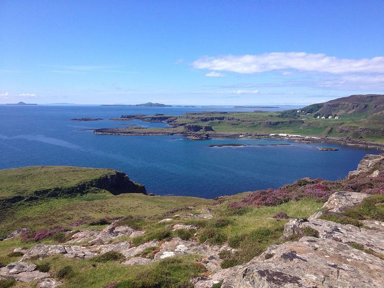
The island is agricultural, formerly growing grain for the monastery on Iona. Once home to a population of over a hundred, it is now down to a tight-knit community of a handful of people, up to a thousand black face sheep, highland cattle, pigs, horses, a flock of feral goats, and red deer. Historical sites on the island include an old burial ground, the remains of two duns and old settlements. It has no school, doctor, or ferry. It has a weekly postal service and issues its own local carriage stamps.
It is part of the Loch Na Keal National Scenic Area, one of 40 in Scotland.
History
The island became part of the Kingdom of the Isles, during the Norse era. Whereas nearby Ulva and Staffa belonged to the MacQuarries from the 10th century, Gometra became a possession of the Iona monastery prior to passing into the hands of the Duke of Argyll. Dean Monro makes no mention of Gometra or Ulva in his 1549 work A Description Of The Western Isles of Scotland but both are referred to briefly by John Monipennie c. 1612, stating of the latter that "about 300 paces from this island, lyeth Gomatra, two miles long and one mile broad".
In 1821 Ulva was sold by the trustees of the MacDonalds of Staffa to Lt-General Charles MacQuarrie (brother of General Lachlan MacQuarrie), and after his death was bought in 1835 by Francis William Clark of Ulva, a lawyer from Stirling, of Morayshire origin who began a brutal clearance of a substantial proportion of the inhabitants of Ulva within a few years. However the MacDonalds of Staffa retained Gometra until 1858 when it was sold to Donald MacLean, who built Gometra House.
In 1932, the island was sold to the English mountaineer Hugh Ruttledge (1884–1961), who had taken early retirement from the Indian Civil Service and planned a life as a farmer. While living on the island, Ruttledge led two British expeditions to Mount Everest, in 1933 and 1936, and took up sailing. In 1950, he moved to Dartmoor.
Gometra House had fallen into disrepair and parts were near collapse by the 1980s, but was reoccupied and restored as a family home in the 1990s. The island's principal exports include blackface breeding stock, lamb, mutton, wool, venison, oysters, vegetables, art and jewellery. There are currently four households on Gometra, and the islanders are dedicated to a low-impact lifestyle, living off-grid, doing without electricity in their homes, washing machines or cars.
In 2012 concerns were expressed by islanders about the siting of a large fish farm by the Scottish Salmon Company in Loch Tuath to the north of the island.
Transport
Weather and tides permitting, it takes about 1 hour and 15 minutes to travel by track from the houses on the west of Gometra to the ferry landing stage on Ulva for the crossing to Mull, using a 4x4 vehicle. The same trip can be done in 50 minutes on a quad bike. By boat from Acarseid Mhòr the journey only takes 20 minutes.