
Time zone CET/CEST (UTC+1/+2) Area 27.36 km² Local time Thursday 8:22 AM Dialling code 038736 | Elevation 48 m (157 ft) Postal codes 19399 Population 3,378 (31 Dec 2008) Postal code 19399 Municipal assoc. Goldberg-Mildenitz | |
 | ||
Weather 4°C, Wind W at 11 km/h, 89% Humidity | ||
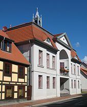
Goldberg is a town in the Ludwigslust-Parchim district, in Mecklenburg-Western Pomerania, Germany. It is situated 24 km northeast of Parchim, and 46 km east of Schwerin.
Contents
- Map of 19399 Goldberg Germany
- History
- Sons and daughters of the town
- Connected to Goldberg
- Gallery
- References
Map of 19399 Goldberg, Germany
History
Goldberg owes its origin and name to a gold mine in the neighbourhood, which, however, has been wholly abandoned since the time of the Hussite wars. The town obtained civic rights in 1211. It suffered heavily from the Tatars in 1241, from the plague in 1334, from the Hussites in 1428, and from the Saxon, Imperial and Swedish forces during the Thirty Years' War. On the 27th of May 1813 a battle took place near it between the French and the Russians; and on the 23rd and the 27th of August of the same year fights between the allies and the French.
Sons and daughters of the town
Connected to Goldberg
Gallery
References
Goldberg, Germany Wikipedia(Text) CC BY-SA