
Country Canada Regional district Strathcona Time zone PST (UTC-8) Elevation 160 m Population 1,267 (2011) | Incorporated 1965 Highways 28 Area 10.78 km² Local time Wednesday 11:38 PM Number of airports 1 | |
 | ||
Weather 3°C, Wind SW at 10 km/h, 96% Humidity | ||
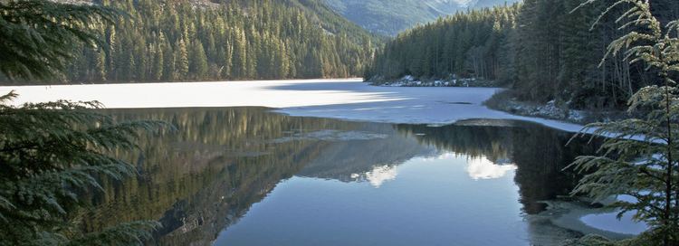
Gold River is a village municipality located close to the geographic centre of Vancouver Island in British Columbia, Canada. In terms of the Island's human geography it is considered to be part of the "North Island", even though it technically is on the Island's west coast.
Contents
Map of Gold River, BC, Canada
History
Taking advantage of its deep water and abundant forests, Gold River developed in 1967 as a prototypical logging and pulp and paper industry community. Gold River quickly sprang into prosperity and established excellent community facilities. When shifting world markets brought the mill closure in 1998, many of Gold River's inhabitants were forced to relocate. Since then, the village has attempted to capitalize on its idealistic setting among picturesque mountains, lakes, rivers, ocean, and forests to develop tourism and sport fishing as its main economic supports.
Currently, Gold River serves as a base for such famous activities as the Nootka Island trek, hiking the Elk Lake trail and mountain climbing Golden Hinde (Vancouver Island's highest peak), Crest Creek climbing crags, MV Uchuck III, and the Great Walk.
Gold River also serves as a historic point, being the closest village to the famous Yuquot, or "Friendly Cove", where British explorer Captain James Cook first set ashore. There Cook met the Mowachaht native band's chief, Chief Maquinna.
Climate
Gold River has a Marine west coast climate (Köppen climate classification Cfb). With warm dry summers and mild rainy winters, during the winter constant Low Pressure Systems moving off of the Pacific Ocean causes winter to be the wettest season. Most precipitation falls as rain year round but snow is not uncommon in the winter months averaging 118 cm (46.5 in) but does not usually stay long. Summers are warm with an average summer temperate of 17.6 °C (63.7 °F) in July. The summer months are the driest of the year with only 55.4 mm (2.2 in) of rain in July compared to 481.9 mm (19.0 in) in November. The average rain fall all year is 2,846.7 mm (112.1 in) making the west coast of Vancouver Island the wettest place in Canada. The record high recorded for the village was 41.5 °C (106.7 °F) recorded on July 28, 2009. The record low was −19 °C (−2.2 °F) recorded on January 28, 1980.