
Country Nepal Zone Bagmati Zone Established 2014 Area 58.5 km² | Region Central District Kathmandu District Time zone NST (UTC+5:45) Local time Thursday 10:14 AM | |
 | ||
Weather 17°C, Wind NE at 3 km/h, 53% Humidity Colleges and Universities Nepal Medical College, Naaya Aayam Multi-Disciplinary Institute Neighborhoods Suntakhan, Mulkharka, Makalbari, Besi Gaun, Bhumthali Points of interest Chisapani Road, Gokarneshwor Mahadev Temple, Baghdwar | ||
Gokarneshwar is a municipality in the Central development region of Kathmandu District in the Bagmati Zone of Nepal. The new municipality was formed by merging five existing villages Sundarijal, Nayapati, Baluwa, Jorpati and Gokarna on 2 December 2014. The office of the municipality is that of the former Jorpati village development committee.
Contents
Map of Gokarneshwor, Nepal
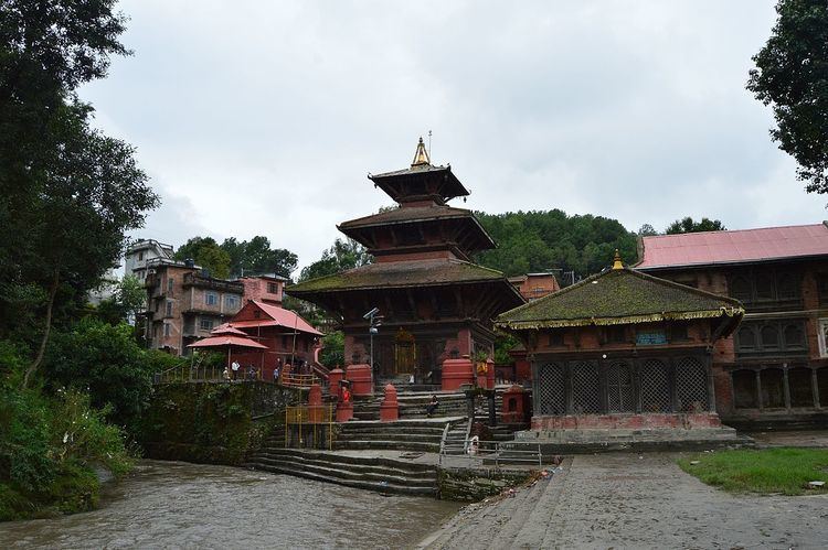
In the village on the banks of the Bagmati River stands the Gokarna Mahadev temple, built in 1582. In late August or early September people go to this temple to bathe and make offerings in honor of their fathers, living or dead, on a day called Gokarna Aunsi.
The Gokarna Forest Reserve is located in the area. Southwest of Gokarna is the Nepal Medical College and Teaching Hospital.
Population
Gokarneshwar municipality has a total population of 107,351 according to 2011 Nepal census. At the time of the 2011 Nepal census the village had a population of 7,508 with 1,768 households.
Notable residents
Writer Ramesh Bikal was born near Gokarna in 1932.