
 | ||
Similar Wandlebury Hill, Wandlebury Country Park, Nine Wells, Beechwoods nature reserve, Leper Chapel - Cambridge | ||
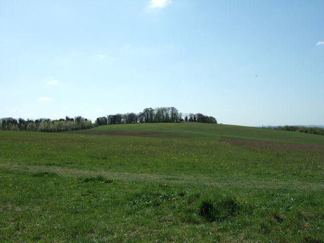
The Gog Magog Downs (also known as the Gog Magog Hills or simply the Gogs) are a range of low chalk hills, extending for several miles to the southeast of Cambridge in England. The highest points are marked on Ordnance Survey 1:25000 maps as "Telegraph Clump" at 75 m (246 ft), Little Trees Hill and Wandlebury Hill, both at 74 m (243 ft). The area is undefined but is roughly the elevated area lying north west of the 41 m (135 ft) col at Worsted Lodge.
Contents
Unlike the nearby hills of the Newmarket Ridge, which have steep sides but very flat tops, these hills have large drops between summits and as such have quite a distinctive appearance; Little Trees Hill looks particularly good from Huckeridge Hill near Sawston. The hills therefore have relatively high topographic prominence. Other tops include: Limepit Hill 56 m (184 ft) — Mag's Hill — Copley Hill — Meggs Hill — Fox Hill — Clarke's Hill — White Hill
HistoryEdit
In English folklore and the Matter of Britain Gogmagog was a giant, and according to Geoffrey of Monmouth's influential 12th-century Historia Regum Britanniae one of the inhabitants of Albion discovered by Brutus of Troy and his men. He was the last of the giants that they killed, and was thrown from a cliff by Corineus.
The book Where Troy Once Stood argues that the ancient city of Troy was in fact located in the Gog Magog Downs; however, this is not taken seriously by scholars.
The earliest mention of the name Gog Magog for this region is found in a decree of 1574, forbidding students to visit the Gog Magog Hills on pain of a fine. Random excavations around the hills revealed the remains of defences at Copley Hill and Cherry Hinton, not older than the Iron Age but the sites themselves are now known already to have been occupied in the Bronze Age. The better-preserved hill fort known as the Wandlebury Ring, which is now situated in a public park, had several concentric ditches and earthen walls, which were kept in place by wooden palisades. It was already inhabited in the Bronze Age and archaeological finds include bronze and iron objects and pottery, including "Knobbed Ware", dating from the Bronze Age.
"Telegraph clump" functioned as one of the locations for the semaphore line, an optical telegraph system, between London and Great Yarmouth from around the 1820s to around 1850.
The dowser and archaeologist Thomas Charles Lethbridge claimed to have found some ancient hill figures buried in the chalk under the surface of the hills. These are purported to represent a sun-god, a moon-goddess and a warrior-god. Lethbridge's claims, however, were controversial and are not widely accepted.
The bulk of the chalk downs were converted to a golf course since 1901 by the Gog Magog Golf Club. but much is designated as a Site of Special Scientific Interest.
Landscape restorationEdit
In 1989 the Magog Trust, a charity and registered company created for the purpose, bought 163.5 acres (66.2 ha) of the downs for £330,000 so it could be returned to chalk grassland and opened to the public. The reserve is across the A1307 road from the Wandlebury Hill country park managed since 1954 by Cambridge Past Present and Future. As well as re-establishing chalkland plants and insects, the Downs have become well used for recreation. A 5-mile running race involving two laps of the reserve and a shorter fun-run have helped raise funds for the local primary school for several years.