Godstone Rural District was a rural district in Surrey, England from 1894 to 1974.
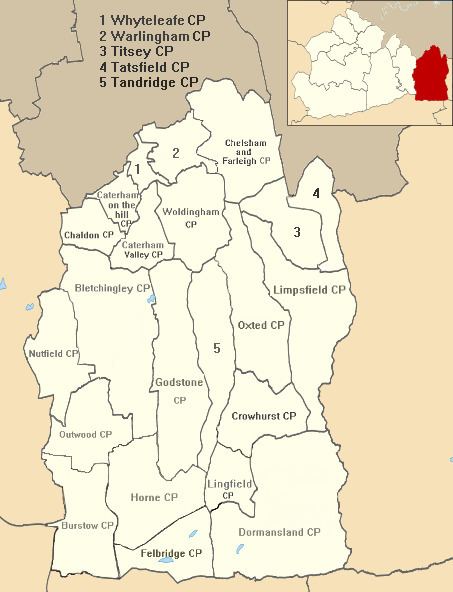
It contained the following civil parishes:
Addington (1915–1925) 14.6 square kilometres (5.6 sq mi) joined from Croydon RD then became component of Croydon (St John the Baptist) Civil Parish also officially known as Croydon within Croydon MB
Bletchingley
Most of Burstow (1933–1974) (joined from abolition of Reigate Rural District, 10 acres given to Horley)
Caterham (1894–1899) (component of new Caterham Urban District then Caterham and Warlingham Urban District)
Chelsham (1894–1969)
Chaldon (1933-1974)
Farleigh (1894–1933) 4.25 square kilometres (1.64 sq mi) (for following 36 years in Coulsdon and Purley Urban District)
Chelsham and Farleigh (1969–1974)
Crowhurst
Felbridge
Godstone
Horne
Limpsfield
Lingfield
Most of Nutfield (1933–1974) (216 acres given to Reigate MB)
Oxted
Tandridge
Tatsfield
Titsey
Warlingham (1894–1929) (component of new Caterham and Warlingham Urban District)
Woldingham (1894–1933) (component of new Caterham and Warlingham Urban District)
With the exception of Addington which was a temporary quite early addition, all of the above areas remained together and were combined with the Caterham and Warlingham Urban District to the north to create Tandridge District which is the easternmost part of Surrey.