
ISO 3166 code IN-WB Area 13.5 km² Population 41,618 (2001) University Gobardanga Hindu College | Time zone IST (UTC+5:30) Lok Sabha constituency Bangaon Elevation 6 m Local time Thursday 4:01 AM | |
 | ||
Weather 18°C, Wind N at 2 km/h, 77% Humidity Neighborhoods Bhattacherjee Para, Kalibari, Master Colony, Purbasha Park | ||
Gobardanga (গোবরডাঙ্গা) is a town and a municipality under Habra police station of Barasat Sadar Subdivision in North 24 Parganas district in the Indian state of West Bengal. It is one of the oldest municipality of West Bengal.
Contents
- Map of Gobardanga West Bengal
- Geography
- Transport
- Demographics
- Higher education
- Schools
- Healthcare
- References
Map of Gobardanga, West Bengal
Geography
Gobardanga is situated on the banks of the river Jamuna.
Transport
Gobardanga railway station is 58 km from Sealdah railway station on the Sealdah–Bangaon branch line of Eastern Railway. From Sealdah it is next to Maslandapur railway station and before Thakurnagar railway station. It is near about 25 km from Bongaon on road.
Demographics
As of 2011 India census, Gobardanga had a population of 57,878. Male Population 29,466 and female Polpulation 28,412.Out of this Population 12,765 is SC and Gobardanga has an average literacy rate of 80%, higher than the national average of 59.5%: male literacy is 84%, and female literacy is 75%. In Gobardanga, 9% of the population is under 6 years of age.
Higher education
There is a NGO named CENTRAL BOARD OF COMPUTER & TECHNICAL EDUCATION (CBCTE) which is regd. under the Public Trust Act- Govt. of India. It is an ISO 9001:2015 certified autonomous organization & also authorized member of Planning Commission( newly formed as NITI Aayog) of IT. All courses regd. under Minister of HRD, Govt. of India. The leading computer & technical education is catering a paradigm shift in DIGITAL LITERACY Program.
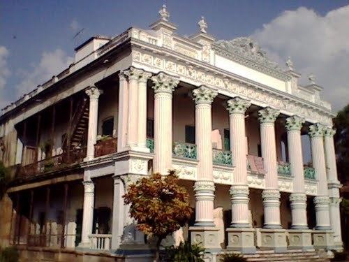
Gobardanga has a college named Gobardanga Hindu College which is affiliated with West Bengal State University.
Schools
Healthcare
North 24 Parganas district has been identified as one of the areas where ground water is affected by arsenic contamination.