Area code(s) +48 34 Area 164.1 km² | Postal code 29-145 Car plates TLW Population 5,171 (2006) | |
 | ||
Voivodeship Świętokrzyskie Voivodeship | ||
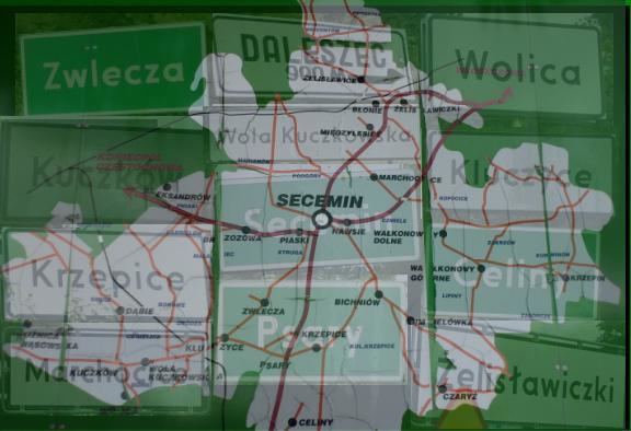
Gmina Secemin is a rural gmina (administrative district) in Włoszczowa County, Świętokrzyskie Voivodeship, in south-central Poland. Its seat is the village of Secemin, which lies approximately 14 kilometres (9 mi) south-west of Włoszczowa and 57 km (35 mi) west of the regional capital Kielce.
Contents
Map of Gmina Secemin, Poland
The gmina covers an area of 164.13 square kilometres (63.4 sq mi), and as of 2006 its total population is 5,171.
Villages
Gmina Secemin contains the villages and settlements of Bichniów, Brzozowa, Celiny, Czaryż, Dąbie, Daleszec, Gabrielów, Gródek, Kluczyce, Krzepice, Krzepin, Kuczków, Lipiny, Maleniec, Marchocice, Międzylesie, Miny, Nadolnik, Osiny, Papiernia, Pniaki, Psary, Psary-Kolonia, Ropocice, Secemin, Wałkonowy Dolne, Wałkonowy Górne, Wincentów, Wola Czaryska, Wola Kuczkowska, Wolica, Zakrzów, Żelisławice, Żelisławiczki and Zwlecza.
Neighbouring gminas
Gmina Secemin is bordered by the gminas of Koniecpol, Radków, Szczekociny and Włoszczowa.
