
Population 9,113 (2006) | Area 146.7 km² | |
 | ||
Voivodeship Świętokrzyskie Voivodeship | ||
Gmina radoszyce dzia ania w latach 2014 16
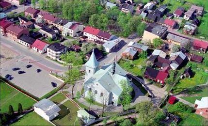
Gmina Radoszyce is a rural gmina (administrative district) in Końskie County, Świętokrzyskie Voivodeship, in south-central Poland. Its seat is the village of Radoszyce, which lies approximately 19 kilometres (12 mi) south-west of Końskie and 33 km (21 mi) north-west of the regional capital Kielce.
Contents
- Gmina radoszyce dzia ania w latach 2014 16
- Map of Gmina Radoszyce Poland
- Gmina radoszyce turniej podstaw wek spartakiada
- Villages
- Neighbouring gminas
- References
Map of Gmina Radoszyce, Poland
The gmina covers an area of 146.71 square kilometres (56.6 sq mi), and as of 2006 its total population is 9,113.
Gmina radoszyce turniej podstaw wek spartakiada
Villages
Gmina Radoszyce contains the villages and settlements of Filipy, Górniki, Grębosze, Grodzisko, Gruszka, Huta, Jacentów, Jakimowice, Jarząb, Jóźwików, Kaliga, Kapałów, Kłucko, Lewoszów, Łysów, Momocicha, Mościska Duże, Mościska Małe, Mularzów, Nadworów, Nalewajków, Pakuły, Plenna, Podlesie, Radoska, Radoszyce, Salachowy Bór, Sęp, Szóstaki, Węgrzyn, Wilczkowice, Wiosna, Wisy, Wyrębów and Zychy.
Neighbouring gminas
Gmina Radoszyce is bordered by the gminas of Końskie, Łopuszno, Mniów, Ruda Maleniecka, Słupia and Smyków.