
Population 9,519 (2006) | Area 85.69 km² | |
 | ||
Website | ||
Gmina Ogrodzieniec is an urban-rural gmina (administrative district) in Zawiercie County, Silesian Voivodeship, in southern Poland. Its seat is the town of Ogrodzieniec, which lies approximately 9 kilometres (6 mi) south-east of Zawiercie and 43 km (27 mi) north-east of the regional capital Katowice.
Contents
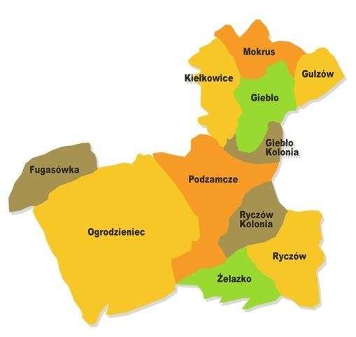
Map of Gmina Ogrodzieniec, Poland
The gmina covers an area of 85.69 square kilometres (33.1 sq mi), and as of 2006 its total population is 9,519 (out of which the population of Ogrodzieniec amounts to 4,465, and the population of the rural part of the gmina is 5,054).
The gmina contains part of the protected area called Eagle Nests Landscape Park.
Villages
Apart from the town of Ogrodzieniec, Gmina Ogrodzieniec contains the villages and settlements of Fugasówka, Giebło, Giebło-Kolonia, Gulzów, Kiełkowice, Markowizna, Mokrus, Podzamcze, Ryczów, Ryczów-Kolonia, Śrubarnia and Żelazko.
Neighbouring gminas
Gmina Ogrodzieniec is bordered by the town of Zawiercie and by the gminas of Klucze, Kroczyce, Łazy and Pilica.