
Population 6,644 (2006) | Area 130.1 km² | |
 | ||
Voivodeship | ||
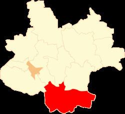
Gmina Dąbie is an urban-rural gmina (administrative district) in Koło County, Greater Poland Voivodeship, in west-central Poland. Its seat is the town of Dąbie, which lies approximately 19 kilometres (12 mi) south-east of Koło and 135 km (84 mi) east of the regional capital Poznań.
Contents
Map of Gmina D%C4%85bie, Poland
The gmina covers an area of 130.06 square kilometres (50.2 sq mi), and as of 2006 its total population is 6,644 (out of which the population of Dąbie amounts to 2,087, and the population of the rural part of the gmina is 4,557).
Villages
Apart from the town of Dąbie, Gmina Dąbie contains the villages and settlements of Augustynów, Baranowiec, Chełmno nad Nerem, Chełmno-Parcele, Chruścin, Cichmiana, Domanin, Gaj, Grabina Wielka, Karszew, Krzewo, Krzykosy, Kupinin, Ladorudz, Lisice, Lutomirów, Majdany, Rośle Duże, Rzuchów, Sobótka, Tarnówka, Tarnówka Wiesiołowska, Wiesiołów and Zalesie-Kolonia.
Neighbouring gminas
Gmina Dąbie is bordered by the gminas of Brudzew, Grabów, Grzegorzew, Koło, Kościelec, Olszówka, Świnice Warckie and Uniejów.