
Seat Czarnia Population 2,756 (2011) | Area 92.53 km² | |
 | ||
Website www.czarnia.samorzady.pl | ||
Gmina Czarnia is a rural gmina (administrative district) in Ostrołęka County, Masovian Voivodeship, in east-central Poland. Its seat is the village of Czarnia, which lies approximately 40 kilometres (25 mi) north-west of Ostrołęka and 127 km (79 mi) north of Warsaw.
Contents
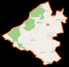
Map of Gmina Czarnia, Poland
The gmina covers an area of 92.53 square kilometres (35.7 sq mi), and as of 2006 its total population is 2,620 (2,756 in 2011).
Villages
Gmina Czarnia contains the villages and settlements of Bandysie, Brzozowy Kąt, Cupel, Cyk, Czarnia, Długie, Michałowo, Rutkowo and Surowe.
Neighbouring gminas
Gmina Czarnia is bordered by the gminas of Baranowo, Chorzele, Myszyniec, Rozogi and Wielbark.
References
Gmina Czarnia Wikipedia(Text) CC BY-SA