
Population 211 (2006 census) Postal code 2365 | Postcode(s) 2365 Elevation 1,150 m Local time Wednesday 6:30 AM | |
 | ||
Weather 14°C, Wind E at 21 km/h, 95% Humidity | ||
Glencoe is a village on the Northern Tablelands, New South Wales, Australia. It is part of the Glen Innes Severn Shire Council local government area. It has an elevation of about 1,150 metres (3,770 ft). At the 2006 census, Glencoe had a population of 211 people.
Map of Glencoe NSW 2365, Australia
Glencoe is located on the New England Highway around 22 kilometres (14 mi) south of Glen Innes. The Main North railway line (now closed) had a platform and sidings, opened 1884, closed 1975.
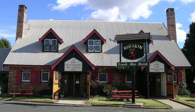
The Red Lion Tavern is located there with a display of artworks and other memorabilia. Bellevue Cottage Gallery and Cafe has a range of crafts and cottage goods from the surrounding district. The historic Uniting Church there is over 100 years old. A sports ground is located on the northern side of the village, along with a fossicking area, to the south, on the creek. Here it may be possible to find sapphires or zircons. The Red Lion has re-opened since November 2011.
Glencoe was named by early European settlers after Glencoe, Scotland. The main industry of the area is sheep and beef cattle breeding with some mining and a vineyard.