
District Nordmøre Area rank 245 in Norway Area 382 km² Population 2,557 (2012) | Demonym(s) Gjemnesing Local time Tuesday 12:56 PM | |
 | ||
Weather 2°C, Wind SW at 26 km/h, 69% Humidity Points of interest Høgset, Reinsfjellet, Hola, Jelkremstranda, Klingren, Litlsanden | ||
Gjemnes is a municipality in Møre og Romsdal county, Norway on the Romsdal peninsula. It is part of the Nordmøre region. The administrative centre is the village of Batnfjordsøra, which lies along the Batnfjorden and it is a former steamship landing place. Other villages in Gjemnes include Torvikbukt, Flemma, Angvika, Gjemnes, Øre, and Osmarka.
Contents
Map of Gjemnes, Norway
General information
The municipality of Gjemnes was established on 1 September 1893 when parts of the municipalities of Kvernes, Øre, and Frei were merged. The initial population of the municipality was 934. On 1 January 1965, Øre Municipality (population: 1,565) and all of Tingvoll Municipality west of the Tingvollfjorden (population: 778) were merged with Gjemnes (population: 697) to form a new, larger municipality of Gjemnes.
Name
The municipality is named after the old Gjemnes farm (Old Norse: *Gímnes), since Gjemnes Church was built there in 1893. The meaning of the first element is probably an old river name (*Gíma), the last element is nes which means "headland".
Coat-of-arms
The coat-of-arms is from modern times. They were granted on 4 November 1983. The arms show the head of a Red Deer on a green background. The green symbolizes the agricultural history of the community. The deer antlers have twelve points on it representing the twelve districts of Gjemnes.
See also: the coats-of-arms of Hitra, Hjartdal, and Voss.Churches
The Church of Norway has two parishes (sokn) within the municipality of Gjemnes. It is part of the Indre Nordmøre deanery in the Diocese of Møre.
Geography
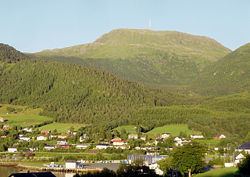
The municipality lies along the Kvernesfjorden, Batnfjorden, Freifjorden, and Tingvollfjorden. The mountain Reinsfjellet (highest in the municipality) lies near Torvikbukt. The municipality also includes the island of Bergsøya which is located at the junction of the fjords near the village of Gjemnes.
Gjemnes is surrounded by Kristiansund Municipality and Averøy Municipality to the north; Eide, Fræna, and Molde municipalities to the west; Nesset Municipality to the south; and Tingvoll Municipality to the east.
Transport
European Route E39 runs through the municipality and over the Gjemnessund Bridge and Bergsøysund Bridge connecting Gjemnes to Tingvoll Municipality. The Freifjord Tunnel (part of Norwegian National Road 70) runs from Bergsøya to the nearby island of Frei (and ultimately Kristiansund).