
Country Pakistan District Gilgit District | Area 72,971 km² | |
 | ||
Colleges and Universities Karakoram International University Points of interest Pamir Mountains, Baltit Fort, Gasherbrum I, Satpara Lake, Masherbrum Similar Islamabad, Gilgit Baltistan, Karachi | ||
Map of Gilgit
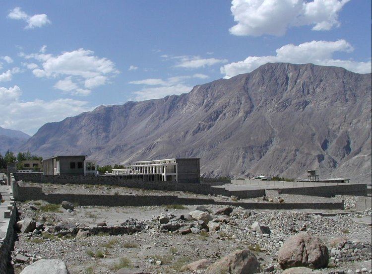
Gilgit (Shina: گلیت, Urdu: گلگت) is the capital city of the Gilgit-Baltistan region, an administrative territory of Pakistan. The city is located in a small valley near the confluence of the Gilgit River and Hunza River. Gilgit is a major tourist destination in northern Pakistan, and serves as a hub for mountaineering expeditions in the Karakoram Range. It was an important stop on the ancient Silk Road, and today serves as a major junction along the Karakoram Highway with road connections to China, Skardu, Chitral, and Islamabad.
Contents
- Map of Gilgit
- Most beautiful place on earth is gilgitbaltistan pakistan
- Gilgit city to islamabad views of kohistan and attock districts from natco
- Etymology
- Early
- Buddhist era
- Gilgit manuscripts
- Trakhn Dynasty
- 1800s
- British Raj
- 1947 Kashmir war
- Religion
- Geography
- Climate
- Administration
- Tourism
- Attractions
- Air
- Road
- Rail
- Education
- Health care
- Sister cities
- References
Most beautiful place on earth is gilgitbaltistan pakistan
Gilgit city to islamabad views of kohistan and attock districts from natco
Etymology
The city's ancient name was Sargin, later to be known as Gilit, and it is still referred to as Gilit or Sargin-Gilit by local people. In the Burushaski language, it is named Geelt and in Wakhi and Khowar it is called Gilt.
Early
Brogpas trace their settlement from Gilgit into the fertile villages of Ladakh through a rich corpus of hymns, songs, and folklore that have been passed down through generations. The Dards and Shinas appear in many of the old Pauranic lists of peoples who lived in the region, with the former also mentioned in Ptolemy's accounts of the region.
Buddhist era
Gilgit was an important city on the Silk Road, along which Buddhism was spread from South Asia to the rest of Asia. It is considered as a Buddhism corridor from which many Chinese monks came to Kashmir to learn and preach Buddhism. Two famous Chinese Buddhist pilgrims, Faxian and Xuanzang, traversed Gilgit according to their accounts.
According to Chinese records, between the 600s and the 700s, the city was governed by a Buddhist dynasty referred to as Little Balur or Lesser Bolü (Chinese: 小勃律). They are believed to be the Patola Sahi dynasty, devout adherents of Vajrayana Buddhism.
In mid-600s, Gilgit came under Chinese suzerainty after the fall of Western Turkic Khaganate due to Tang military campaigns in the region. In late 600s CE, the rising Tibetan Empire wrestled control of the region from the Chinese. However, faced with growing power of the Abbasid Empire to the west, the Tibetans were forced to ally themselves with the Abbasids. The region was then contested by Chinese and Tibetan forces, and their respective vassal states, until the mid-700s. Chinese record of the region last until late-700s at which time the Tang's western military campaign was weakened due to the An Lushan Rebellion.
Gilgit manuscripts
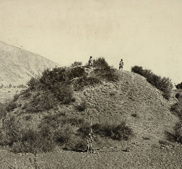
This corpus of manuscripts was discovered in 1931 in Gilgit, containing many Buddhist texts such as four sutras from the Buddhist canon, including the famous Lotus Sutra. The manuscripts were written on birch bark in the Buddhist form of Sanskrit in the Sharada script. They cover a wide range of themes such as iconometry, folk tales, philosophy, medicine and several related areas of life and general knowledge.
The Gilgit manuscripts were nominated in 2006 to be included on the UNESCO Memory of the World register, but without success. The Gilgit manuscripts are among the oldest manuscripts in the world, and the oldest manuscript collection surviving in Pakistan, having major significance in the areas of Buddhist studies and the evolution of Asian and Sanskrit literature. The manuscripts are believed to have been written in the 5th to 6th centuries AD, though some more manuscripts were discovered in the succeeding centuries, which were also classified as Gilgit manuscripts.
As of 6 October 2014, one source claims that the part of the collection deposited at the Sri Pratap Singh Museum in Srinagar was irrecoverably destroyed during the 2014 India–Pakistan floods.
Trakhàn Dynasty
Gilgit was ruled for centuries by the local Trakhàn Dynasty, which ended about 1810 with the death of Raja Abas, the last Trakhàn Raja. The rulers of Hunza and Nager also claim origin with the Trakhàn dynasty. They claim descent from a heroic Kayani Prince of Persia, Azur Jamshid (also known as Shamsher), who secretly married the daughter of the king Shri Badat. She conspired with him to overthrow her cannibal father. Sri Badat's faith is theorised as Hindu by some and Buddhist by others. However, considering the region's Buddhist heritage, with the most recent influence being Islam, the most likely preceding influence of the region is Buddhism. Though the Sanskrit titular Sri and the name Badat could denotes a Hindu origin of this ruler, adherents to Buddhism frequently employed Sankrit in the use of Buddhist texts.
Prince Azur Jamshid succeeded in overthrowing King Badat who was known as the Adam Khor (literally man-eater), often demanding a child a day from his subjects, his demise is still celebrated to this very day by locals in traditional annual celebrations. In the beginning of the new year, where a Juniper procession walks along the river, in memory of chasing the cannibal king Sri Badat away.
Azur Jamshid abdicated after 16 years of rule in favour of his wife Nur Bakht Khatùn until their son and heir Garg, grew of age and assumed the title of Raja and ruled, for 55 years. The dynasty flourished under the name of the Kayani dynasty until 1421 when Raja Torra Khan assumed rulership. He ruled as a memorable king until 1475. He distinguished his family line from his step brother Shah Rais Khan (who fled to the king of Badakshan, and with whose help he gained Chitral from Raja Torra Khan), as the now-known dynastic name of Trakhàn. The descendants of Shah Rais Khan were known as the Ra'issiya Dynasty.
1800s
The area had been a flourishing tract but prosperity was destroyed by warfare over the next fifty years, and by the great flood of 1841 in which the river Indus was blocked by a landslip below the Hatu Pir and the valley was turned into a lake. After the death of Abas, Sulaiman Shah, raja of Yasin, conquered Gilgit. Then, Azad Khan the cheater, Raja of Punial, killed Sulaiman Shah, taking Gilgit; then Tair Shah, Raja of Buroshall (Nagar), took Gilgit and killed Azad Khan. Tair Shah's son Shah Sakandar inherited, only to be killed by Gohar Aman, Raja of Yasin of the Khushwakhte Dynasty, when he took Gilgit. Then in 1842, Shah Sakandar's brother, Karim Khan, expelled yasin rulers with the support of a Sikh army from Kashmir. The Sikh general, Nathu Shah, left garrison troops and Karim Khan ruled until Gilgit was ceded to Gulab Singh of Jammu and Kashmir in 1846 by the Treaty of Amritsar, and Dogra troops replaced the Sikh in Gilgit.
Nathu Shah and Karim Khan both transferred their allegiance to Gulab Singh, continuing local administration. When Hunza attacked in 1848, both of them were killed. Gilgit fell to the Hunza and their Yasin and Punial allies, but was soon reconquered by Gulab Singh's Dogra troops. With the support of Raja Gohar Aman, Gilgit's inhabitants drove their new rulers out in an uprising in 1852. Raja Gohar Aman then ruled Gilgit until his death in 1860, just before new Dogra forces from Ranbir Singh, son of Gulab Singh, captured the fort and town. In the 1870s Chitral was threatened by Afghans, Maharaja Ranbir Singh was firm in protecting Chitral from Afghans, the Mehtar of Chitral asked for help. In 1876 Chitral accepted the authority of Jammu Clan and in reverse get the protection from the Dogras who have in the past took part in many victories over Afghans during the time of Gulab Singh Dogra.
British Raj
In 1877, in order to guard against the advance of Russia, the British India Government, acting as the suzerain power of the princely state of Jammu Kashmir, established the Gilgit Agency. The Agency was re-established under control of the British Resident in Jammu and Kashmir. It comprised the Gilgit Wazarat; the State of Hunza and Nagar; the Punial Jagir; the Governorships of Yasin, Kuh-Ghizr and Ishkoman, and Chilas.
The Tajiks of Xinjiang sometimes enslaved the Gilgiti and Kunjuti Hunza.
In 1935, the British India government demanded from the Jammu and Kashmir state to lease them Gilgit town plus most of the Gilgit Agency and the hill-states Hunza, Nagar, Yasin and Ishkoman for 60 years. The Maharaja Hari Singh leases it for Rs. 75,000. The leased region was then treated as part of British India, administered by a Political Agent at Gilgit responsible to Delhi, first through the Resident in Jammu and Kashmir and later a British Agent in Peshawar.
Jammu and Kashmir State no longer kept troops in Gilgit and a mercenary force, the Gilgit Scouts, was recruited with British officers and paid for by Delhi. In April 1947, Delhi decided to formally retrocede the leased areas to Hari Singh’s Jammu and Kashmir State as of 15 August 1947. The transfer was to formally take place on 1 August. However, the Gilgit Scouts rebelled against this action, and under the guidance of Major WA 'Willie' Brown, ceded to the newly founded state of Pakistan.
Abdullah Sahib was an Arain and belonged to Chimkor Sahib village of Ambala district Punjab, British India. Abdullah Sahib was the first Muslim governor of the Gilgit in British time period and was close associate of Maharaja Partap Singh.
Khan Bahadur Kalay Khan, a Mohammed Zai Pathan, was the Governor of Gilgit Hunza and Kashmir before partition.
1947 Kashmir war
On 26 October 1947, Maharaja Hari Singh of Jammu and Kashmir, faced with a tribal invasion by Pakistan, signed the Instrument of Accession, joining India.
Gilgit's population did not favour the State's accession to India. Sensing their discontent, Major William Brown, the Maharaja's commander of the Gilgit Scouts, mutinied on 1 November 1947, overthrowing the Governor Ghansara Singh. The bloodless coup d'état was planned by Brown to the last detail under the code name `Datta Khel'. A provisional government (Aburi Hakoomat) was established by the Gilgit locals with Raja Shah Rais Khan as the president and Mirza Hassan Khan as the commander-in-chief. However, Major Brown had already telegraphed Khan Abdul Qayyum Khan asking Pakistan to take over. The Pakistani political agent, Khan Mohammad Alam Khan, arrived on 16 November and took over the administration of Gilgit. Historian Yaqiob Khan Bangash concludes that the people of Gilgit, Chilas, Koh Ghizr, Ishkoman, Yasin, Punial, Hunza and Nagar joined Pakistan by their own choice.
Religion
About 99% of the population of Gilgit is Muslim, with 71% being Twelver Shia Muslims, 17% being Ismaili Shia Muslims and 12% being Sunni Muslims.
Geography
Gilgit is situated in a valley formed by the confluence of the Indus River, Hunza River and Gilgit River.
Climate
Gilgit experiences a cold desert climate (Köppen climate classification BWk). Weather conditions for Gilgit are dominated by its geographical location, a valley in a mountainous area, southwest of Karakoram range. The prevalent season of Gilgit is winter, occupying the valley eight to nine months a year.
Gilgit lacks significant rainfall, averaging in 120 to 240 millimetres (4.7 to 9.4 in) annually, as monsoon breaks against the southern range of Himalayas. Irrigation for land cultivation is obtained from the rivers, abundant with melting snow water from higher altitudes.
The summer season is brief and hot. Strong sunshine occasionally raises temperaturs to 40 °C (104 °F), though it typically is cooler in the shade. As a result of this extremity in the weather, landslides and avalanches are frequent in the area.
Administration
The city of Gilgit constitutes a tehsil within Gilgit District.
Tourism
Gilgit city is one of the two major hubs for all mountaineering expeditions in Gilgit-Baltistan. Almost all tourists headed for treks in Karakoram or Himalaya Ranges depart from Gilgit
Attractions
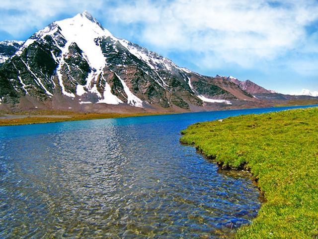
There are several tourist attractions relatively close to Gilgit: Naltar Valley with Naltar Peak, Hunza Valley, Nagar Valley, Fairy Meadow in Raikot, Shigar town, Skardu Valley, Haramosh Valley in Karakoram Range, Bagrot Valley, Deosai National Park in Skardu, Astore Valley, Phunder village, Ghizer Valley, The Land Of Lakes,Yasin Valley,Thoi Valley, Kargah Valley and Nomal Valley.
Air
Gilgit is served by the nearby Gilgit Airport, with direct flights to Islamabad.
Road
Gilgit is located approximately 10 kilometres (6.2 mi) from the Karakoram Highway (KKH). The roadway is being upgraded as part of the China–Pakistan Economic Corridor. The KKH connects Gilgit to Chilas, Dasu, Besham, Mansehra, Abbottabad and Islamabad in the south. Gilgit is connected to Karimabad (Hunza) and Sust in the north, with further connections to the Chinese cities of Tashkurgan, Upal and Kashgar in Xinjiang. Gilgit is also linked to Chitral in the west, and Skardu to the east. The road to Skardu will be upgraded to a 4-lane road at a cost of $475 million.
Transport companies such as the Silk Route Transport Pvt, Masherbrum Transport Pvt and Northern Areas Transport Corporation (NATCO), offer passenger road transport between Islamabad, Gilgit, Sust, and Kashgar and Tashkurgan in China.
The Astore-Burzul Road, linking Gilgit to Srinagar was closed in 1978.
Rail
Gilgit is not served by any rail connections. Long-term plans for the China–Pakistan Economic Corridor call for construction of the 682 kilometre long Khunjerab Railway, which is expected to be completed in 2030, that would also serve Gilgit.
Education
Health care
Gilgit city has following healthcare facilities