
 | ||
Similar Gabal El Uweinat, Abu Ballas, Siwa Oasis, Tibesti Mountains, Tadrart Acacus | ||
Gilf kebir an expedition into no man s land
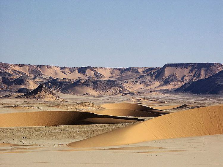
Gilf Kebir (جلف كبير) (var. Gilf al-Kebir, Jilf al Kabir) is a plateau in the New Valley Governorate of the remote southwest corner of Egypt, and southeast Libya. Its name translates as "the Great Barrier". This 7770-square-kilometre sandstone plateau, roughly the size of Puerto Rico, rises 300m from the Libyan Desert floor.
Contents
- Gilf kebir an expedition into no man s land
- Map of Hadabat al Jilf al Kabir Qesm Al Wahat Ad Dakhlah New Valley Governorate Egypt
- Prehistoric paintings in gilf kebir
- Geography and climate
- Climate
- Wadis
- Petroglyphs
- 20th century exploration
- WWII archeology
- Literary setting
- Curiosity
- References
Map of Hadabat al Jilf al Kabir, Qesm Al Wahat Ad Dakhlah, New Valley Governorate, Egypt
The name Gilf Kebir was given to the plateau by Prince Kamal el Dine Hussein in 1925, as it had no local name. It is known for its rugged beauty, remoteness, geological interest, and the dramatic cliff paintings-pictographs and rock carvings-petroglyphs which depict an earlier era of abundant animal life and human habitation.
Prehistoric paintings in gilf kebir
Geography and climate
The Uweinat mountain range at the very south of the plateau extends from Egypt into Libya and Sudan.
Climate
Gilf Kebir Plateau lies in the heart of the eastern part of the vast Sahara Desert, and, thus, gets some of the most extreme climates on Earth. This is the driest place on the planet, not only because the area is totally rainless (the annual average rainfall amount hardly reaches 0.1 mm) but also because the geological aridity index/dryness ratio is over 200, which means that the solar energy received at the ground evaporate 200 times the amount of precipitation received. Rainfall may fall every twenty years in Gilf Kebir.
Wadis
The plateau is crisscrossed by Wadis (dry, seasonal riverbeds). These include:
Petroglyphs
The Gilf Kebir is known for its prehistoric Neolithic petroglyphs
Saharan rock art has been found to resemble art of Nile valleys. The Saharan area was more wet until mid-Holocene or about 4000 BC, when the monsoon retreated southwards, forcing humans to migrate. Some retreated eastward to the Nile valley, taking with them their beliefs and influencing Egyptian art.
20th century exploration
The hills of the Gilf Kebir were first seen from a distance by European explorers in 1910 - with W. J. Harding-King in 1910 and 1911, and Dr. Ball and Lieutenant Moore in 1918. The high southern part of the plateau was sighted for the first time by Prince Kamal el Dine Hussein in 1925, and on another expedition in the following year he fixed the eastern escarpment of the plateau and first realised the true size of the plateau. In 1930 an expedition headed by Ralph Alger Bagnold followed the same route. In the winter of 1930-1 P. A. Clayton surveyed some of the area.
The western side of the Gilf Kebir was explored in 1932 by the Clayton-Almásy Expedition, headed by Sir Robert East Clayton and Count László E. Almásy, and accompanied by Patrick A. Clayton, Squadron Leader H. W. G. J. Penderel, three Arabian car drivers and a cook. The expedition explored the area by Gypsy Moth plane, by car and on foot.
WWII archeology
The plateau was the site for various British logistical operations during the Second World War, and due to the extremely dry conditions and lack of population, remains of this occupation are often found intact. A large airbase, including huge navigation arrows laid out in army petrol cans, can still be seen.
It was also the site of the recent discovery of a bag which had been lost in the Second World War by a dispatch rider (Alec Ross) of the Long Range Desert Group, part of the British Army. This contained the rider's personal letters and photographs, and had been well preserved.
Literary setting
The Gilf Kebir is the setting for part of Michael Ondaatje's novel The English Patient. It also plays an important role in Paul Sussman's The Hidden Oasis.
Curiosity
In 2006, Gilf Kebir Desert was the site of an extreme sports record from Italian runner Stefano Miglietti. On 14 December 2006, Miglietti crossed the desert by foot, taking only 3 days and 5 hours to cover the full 340 km trail, running at an average speed of 9 km/h. Miglietti started from Wadi Mashi and arrived at Silica Glass, a desert close to the Gilf Kebir desert.