
Local time Monday 9:35 PM | Population 24 | |
 | ||
Weather 1°C, Wind N at 3 km/h, 88% Humidity Voivodeship Warmian-Masurian Voivodeship | ||
Gierłoż [ˈɡʲɛrwɔʂ] (German Görlitz) is a village in the administrative district of Gmina Kętrzyn, within Kętrzyn County, Warmian-Masurian Voivodeship, in north-east Poland. It lies approximately 8 kilometres (5 mi) east of Kętrzyn and 74 km (46 mi) north-east of the regional capital Olsztyn.
Map of Gier%C5%82o%C5%BC, Poland
Before 1945 the area was part of Germany (East Prussia).
The village has a population of 24.
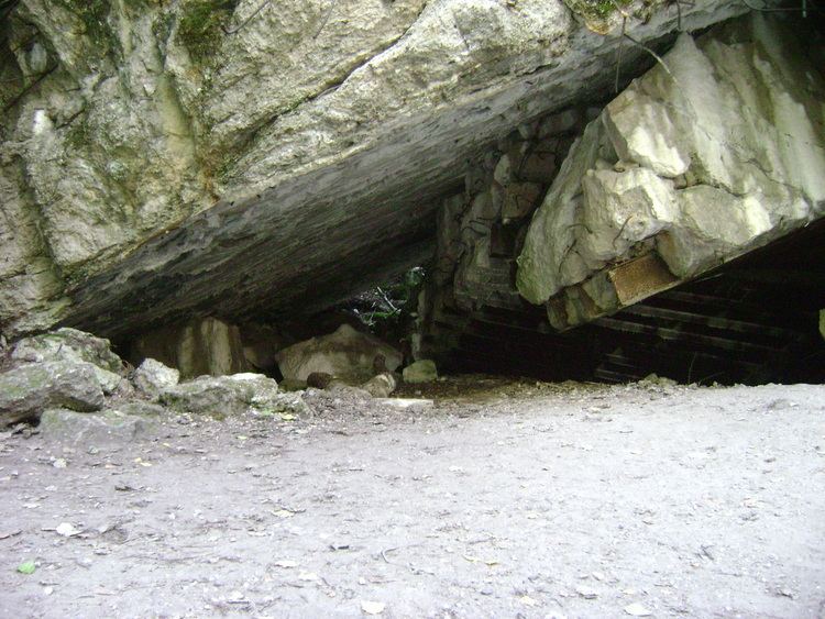
Adolf Hitler's military headquarters from June 21, 1941 to November 20, 1944 were situated here in a bunker, called The Wolf's Lair.
References
Gierłoż, Kętrzyn County Wikipedia(Text) CC BY-SA